MyTopo
Pink Hill North Carolina US Topo Map
Couldn't load pickup availability
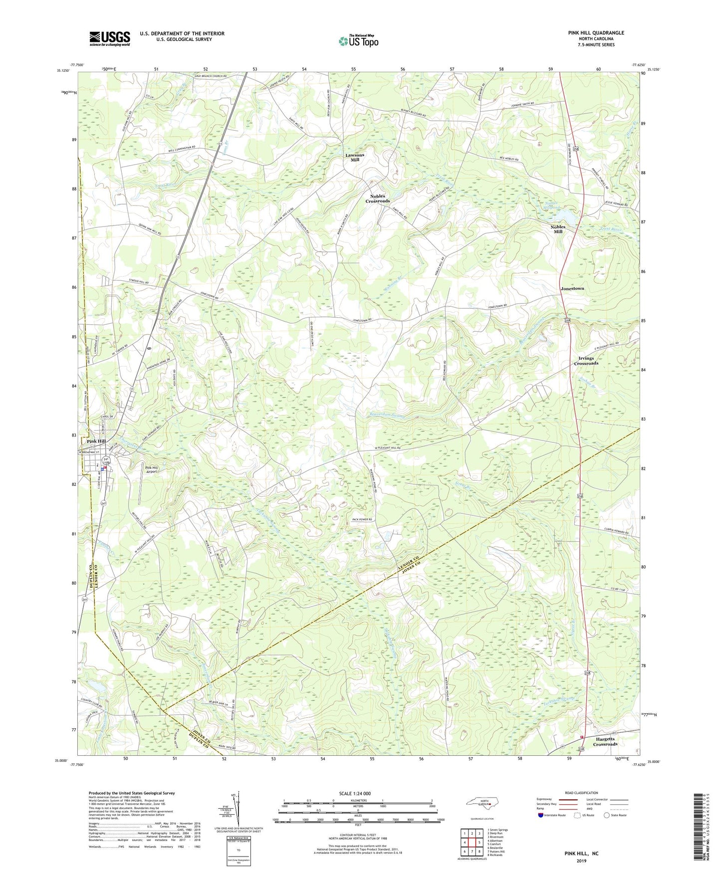
2022 topographic map quadrangle Pink Hill in the state of North Carolina. Scale: 1:24000. Based on the newly updated USGS 7.5' US Topo map series, this map is in the following counties: Lenoir, Jones, Duplin. The map contains contour data, water features, and other items you are used to seeing on USGS maps, but also has updated roads and other features. This is the next generation of topographic maps. Printed on high-quality waterproof paper with UV fade-resistant inks.
Quads adjacent to this one:
West: Albertson
Northwest: Seven Springs
North: Deep Run
Northeast: Rivermont
East: Comfort
Southeast: Richlands
South: Potters Hill
Southwest: Beulaville
This map covers the same area as the classic USGS quad with code o35077a6.
Contains the following named places: Bethel Church, Cedar Grove Church, Cherry Hill Fire District, Cherrytree Branch, Gray Branch Church, Great Branch, Great Branch Community Church, Hargetts Crossroads, Hargetts Crossroads Volunteer Fire Department, Horse Branch, Howards Chapel, Irvings Crossroads, Jonestown, Lawsons Mill, Lenoir Emergency Medical Services, Mount Zion Church, Neuse Regional Library - Pink Hill Branch Library, Nobels Millpond, Nobels Millpond Dam, Nobles Church, Nobles Crossroads, Nobles Mill, Old Pink Hill Church, Pink Hill, Pink Hill Airport, Pink Hill Elementary School, Pink Hill Fire Department, Pink Hill Police Department, Pink Hill Post Office, Pink Hill Town Hall, Running Branch, Smith Chapel, Stroud Pond, Tickahoe, Town of Pink Hill, Township of Pink Hill, Turners Chapel, Unity Free Will Baptist Church, Whaleys Chapel, ZIP Code: 28572