MyTopo
Rolesville North Carolina US Topo Map
Couldn't load pickup availability
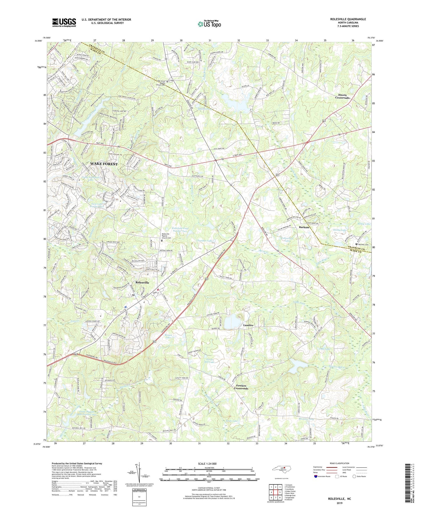
2019 topographic map quadrangle Rolesville in the state of North Carolina. Scale: 1:24000. Based on the newly updated USGS 7.5' US Topo map series, this map is in the following counties: Wake, Franklin. The map contains contour data, water features, and other items you are used to seeing on USGS maps, but also has updated roads and other features. This is the next generation of topographic maps. Printed on high-quality waterproof paper with UV fade-resistant inks.
Quads adjacent to this one:
West: Wake Forest
Northwest: Grissom
North: Franklinton
Northeast: Louisburg
East: Bunn West
Southeast: Zebulon
South: Knightdale
Southwest: Raleigh East
Contains the following named places: Austin Creek, Barham, Beulah Church, Blackley Pond, Blackley Pond Dam, Brown Lake, Camp Adventure Lake, Camp Durant Lake Number One, Cedar Fork, Chandler Lake, Clement Academy, Corinth United Church, Falls Lake, Fellowship Lake, Fowlers Crossroads, Fowlers Mill Creek, Freemans Mill, Harris Chapel, Harris Crossroads, Lassiter, Mitchell Cemetery, Mitchell Pond, Mitchell Pond Dam, Mitchells Mill, Moores Pond, Moores Pond Dam, Mount Calvary Church, Oak Grove Baptist Church Cemetery, Oak Grove Church, Penny Hill Lake, Penny Hill Lake Dam, Perry Creek, Rolesville, Rolesville Baptist Church Cemetery, Rolesville Elementary School, Rolesville Emergency Medical Services Station 6, Rolesville Police Department, Rolesville Post Office, Rolesville Rural Fire Department, Shearon Lake, Shearon Lake Dam, Smiths Lake, Town of Rolesville, Township of Wake Forest, Twin Lake Number Two, Wake Forest Municipal Dam, Wakefield Pond Number Two, Watkins Pond Dam, ZIP Codes: 27571, 27596