MyTopo
Rowan North Carolina US Topo Map
Couldn't load pickup availability
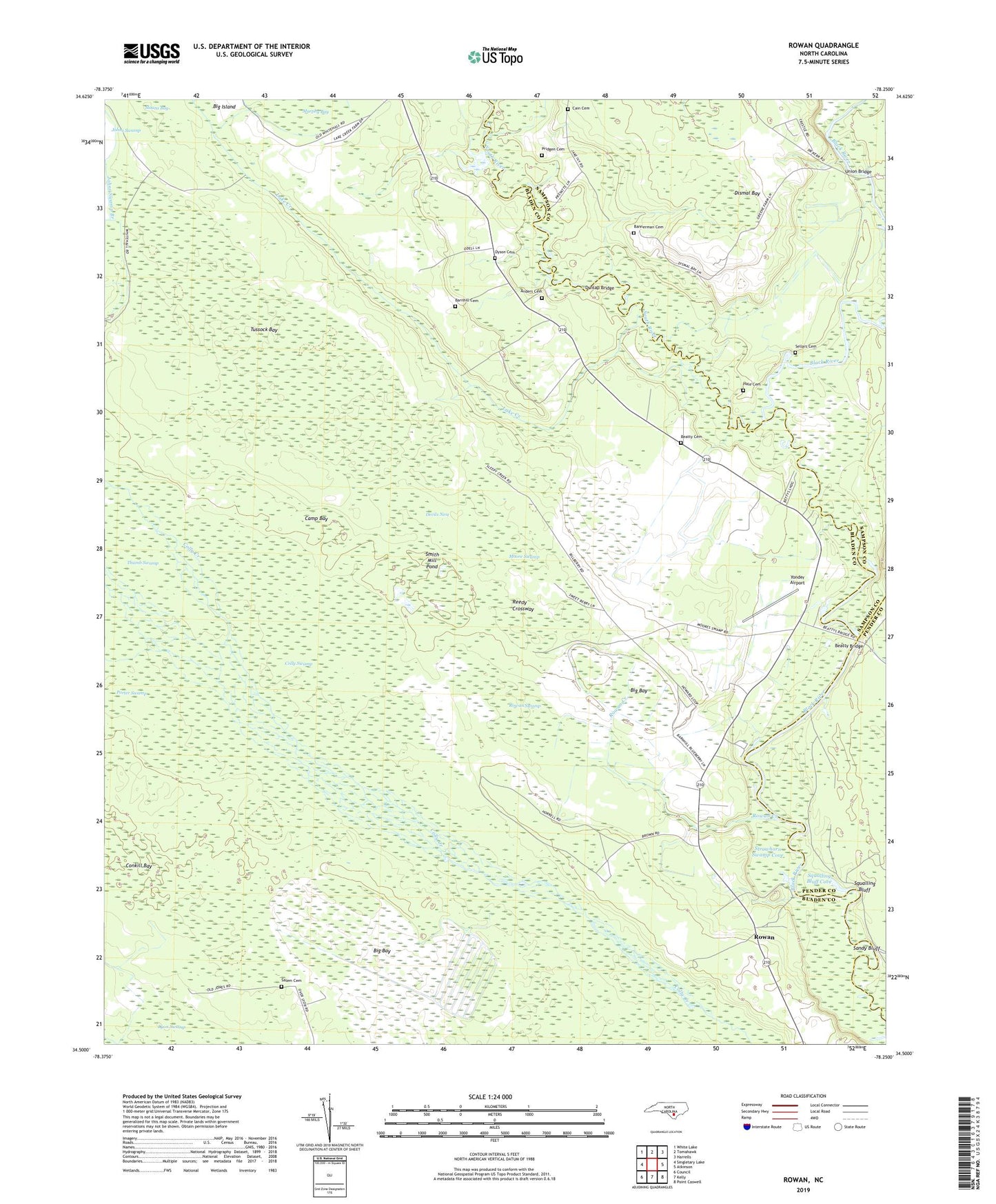
2019 topographic map quadrangle Rowan in the state of North Carolina. Scale: 1:24000. Based on the newly updated USGS 7.5' US Topo map series, this map is in the following counties: Bladen, Sampson, Pender. The map contains contour data, water features, and other items you are used to seeing on USGS maps, but also has updated roads and other features. This is the next generation of topographic maps. Printed on high-quality waterproof paper with UV fade-resistant inks.
Quads adjacent to this one:
West: Singletary Lake
Northwest: White Lake
North: Tomahawk
Northeast: Harrells
East: Atkinson
Southeast: Point Caswell
South: Kelly
Southwest: Council
Contains the following named places: Anders Cemetery, Bakers Landing, Bannerman Cemetery, Barnhill Cemetery, Beatty Bridge, Beatty Cemetery, Big Bay, Cain Cemetery, Camp Bay, Conkill Bay, Davis Landing, Devils Nest, Dismal Bay, Dunlap Bridge, Dyson Cemetery, Hale Cemetery, Henry Landing, Lake Creek, Lake Creek Community House, Lyon Swamp, Moore Swamp, Moore Swamp Church, Pridgen Cemetery, Reedy Crossway, Rowan, Rowan Creek, Rowan Swamp, Saint James Church, Salem Cemetery, Sandy Bluff, Sandy Bluff Landing, Sellars Cemetery, Sikes Landing, Smith Mill Pond, Snow Hill Church, South River, Squalling Bluff, Squalling Bluff Cove, Still Landing, Strawhorn Landing, Strawhorn Swamp Cove, Tar Landing, Toms Hole, Township of Lake Creek, Tussock Bay, Union Bridge, Wilson Chapel, Yonder Airport, ZIP Codes: 28447, 28448