MyTopo
Salemburg North Carolina US Topo Map
Couldn't load pickup availability
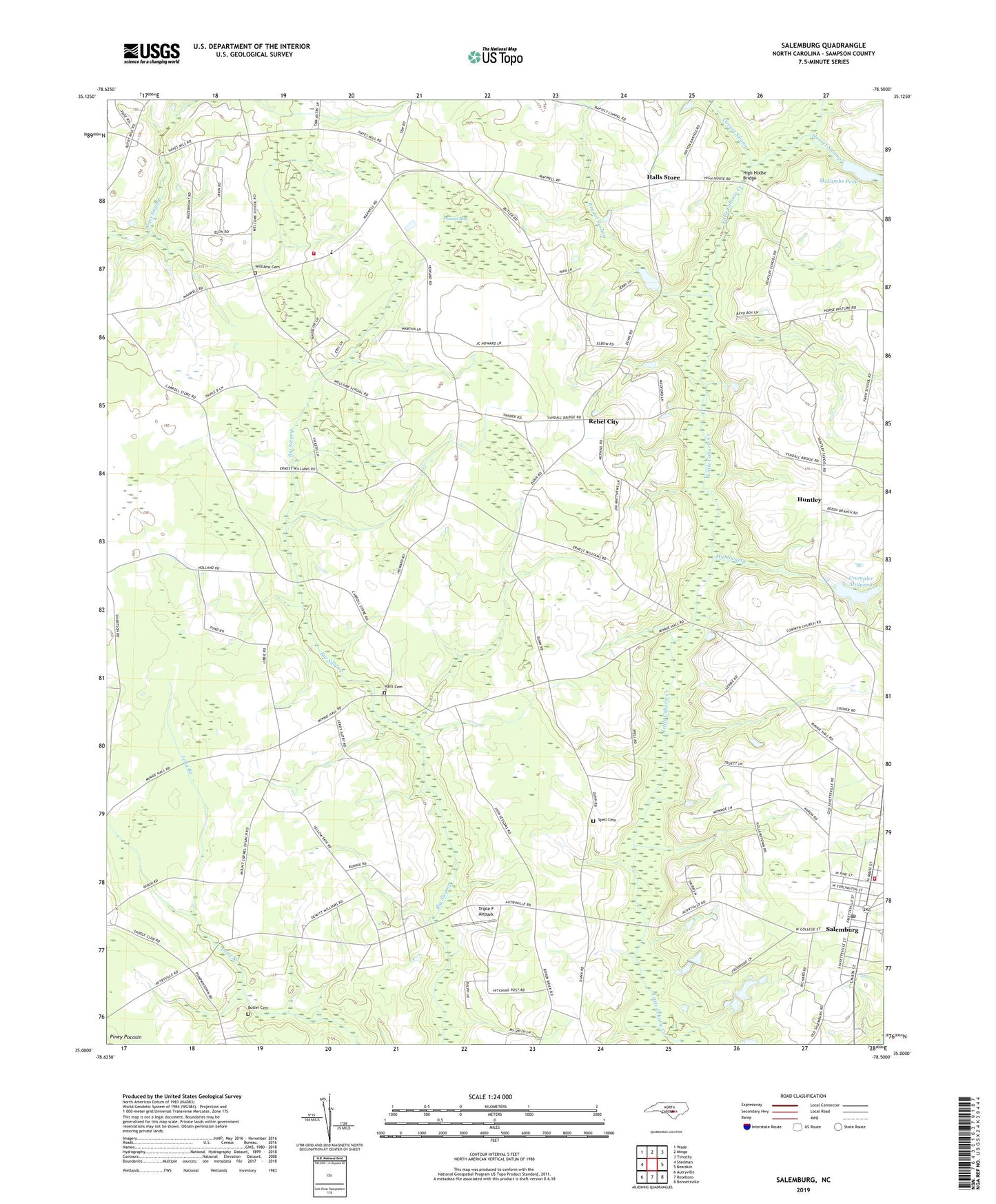
2019 topographic map quadrangle Salemburg in the state of North Carolina. Scale: 1:24000. Based on the newly updated USGS 7.5' US Topo map series, this map is in the following counties: Sampson. The map contains contour data, water features, and other items you are used to seeing on USGS maps, but also has updated roads and other features. This is the next generation of topographic maps. Printed on high-quality waterproof paper with UV fade-resistant inks.
Quads adjacent to this one:
West: Stedman
Northwest: Wade
North: Mingo
Northeast: Timothy
East: Bearskin
Southeast: Bonnetsville
South: Roseboro
Southwest: Autryville
Contains the following named places: Bethabara Church, Betty Branch, Beulah Church, Bryant Swamp, Butler Cemetery, Caesar Swamp, Clement School, Clement Volunteer Fire Department, Crumpler Millpond, Dismal Bay, Elizabeth Church, Faith Church, Halls Cemetery, Halls Church, Halls Crossroads, Halls Store, Hays Mill, High House Bridge, Hollands Chapel, Hornet Swamp, Huntley, Long Branch Church, Mathews Pond, Matthew Pond Dam, McLambs Pond, McLambs Pond Dam, Mill Swamp, Minson M Williams Memorial Cemetery, Mount Carmel Church, Oakhurst School, Oakview School, Peniel Church, Rebel City, Salemburg, Salemburg Elementary School, Salemburg Post Office, Salemburg Volunteer Fire Department, Shady Mill, Spell Cemetery, Town of Salemburg, Township of Dismal, Triple F Airpark, Underwoods Store, Union Chapel, Union Grove Church, Welcome School, ZIP Code: 28318