MyTopo
Scranton North Carolina US Topo Map
Couldn't load pickup availability
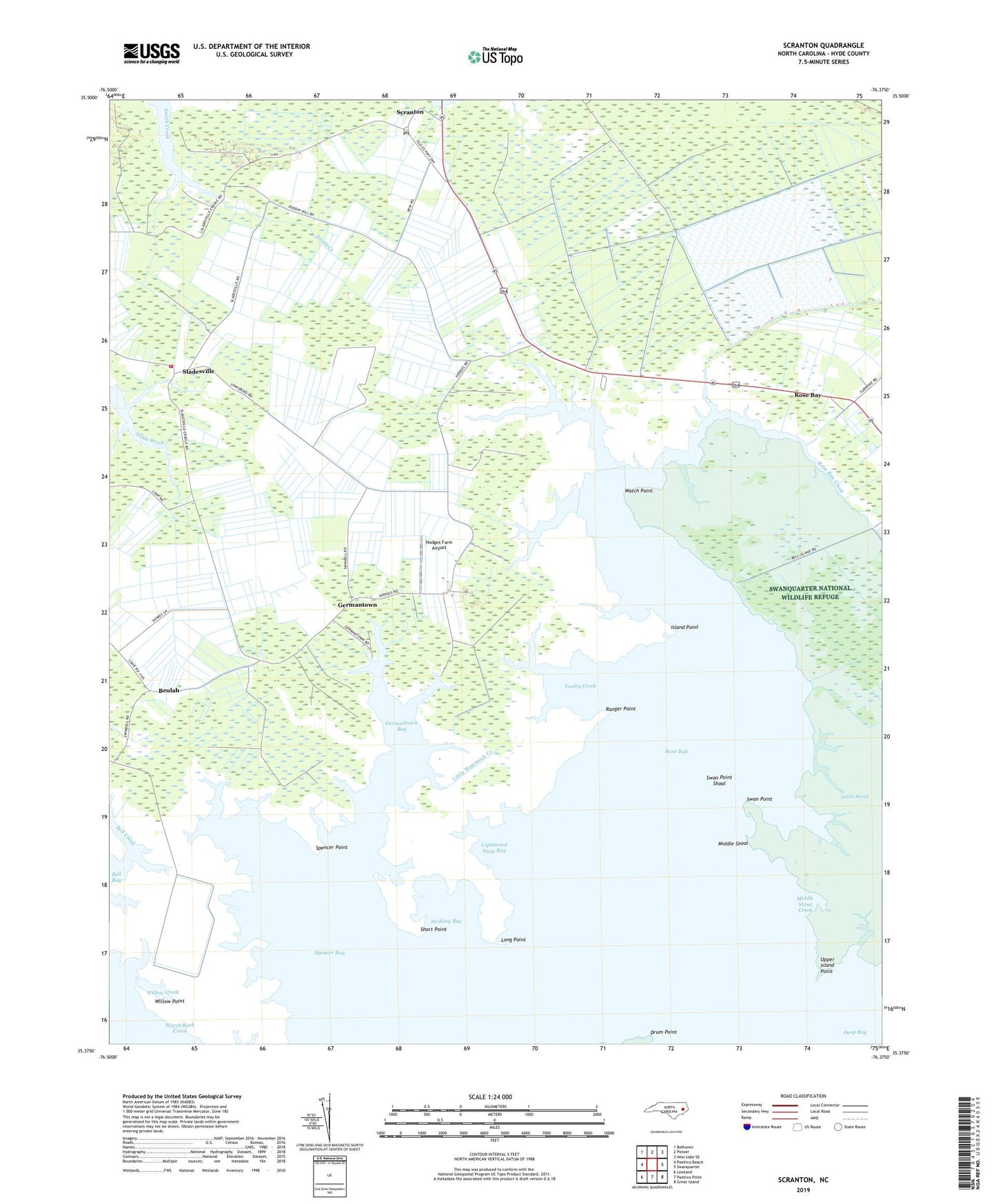
2019 topographic map quadrangle Scranton in the state of North Carolina. Scale: 1:24000. Based on the newly updated USGS 7.5' US Topo map series, this map is in the following counties: Hyde. The map contains contour data, water features, and other items you are used to seeing on USGS maps, but also has updated roads and other features. This is the next generation of topographic maps. Printed on high-quality waterproof paper with UV fade-resistant inks.
Quads adjacent to this one:
West: Pamlico Beach
Northwest: Belhaven
North: Ponzer
Northeast: New Lake SE
East: Swanquarter
Southeast: Great Island
South: Pamlico Point
Southwest: Lowland
Contains the following named places: Bell Bay, Bell Creek, Bell Island Recreation Area, Berry Creek, Beulah, Chellybelle Creek, Ditch Creek, Drum Point, Eunice Chapel, Germantown, Germantown Bay, Hodges Farm Airport, House Creek, Hyde County Training School, Island Point, Jeanette Creek, Lightwood Snag Bay, Little Hammock Creek, Long Creek, Long Point, Marsh Rock Creek, Middle Shoal, Middle Shoal Creek, Midgette Creek, Old Haulover, Ranger Point, Rose Bay, Rose Bay Creek, Saint Johns Church, Scranton, Scranton Post Office, Scranton Volunteer Fire Department, Short Point, Sladesville, Spencer Bay, Spencer Point, Stave Landing, Striking Bay, Swan Creek, Swan Point, Swan Point Shoal, Swanquarter National Wildlife Refuge, Tooley Creek, Upper Island Point, Watch Point, Weeping Mary Church, Willow Creek, Willow Point, Zion Church