MyTopo
Lowland North Carolina US Topo Map
Couldn't load pickup availability
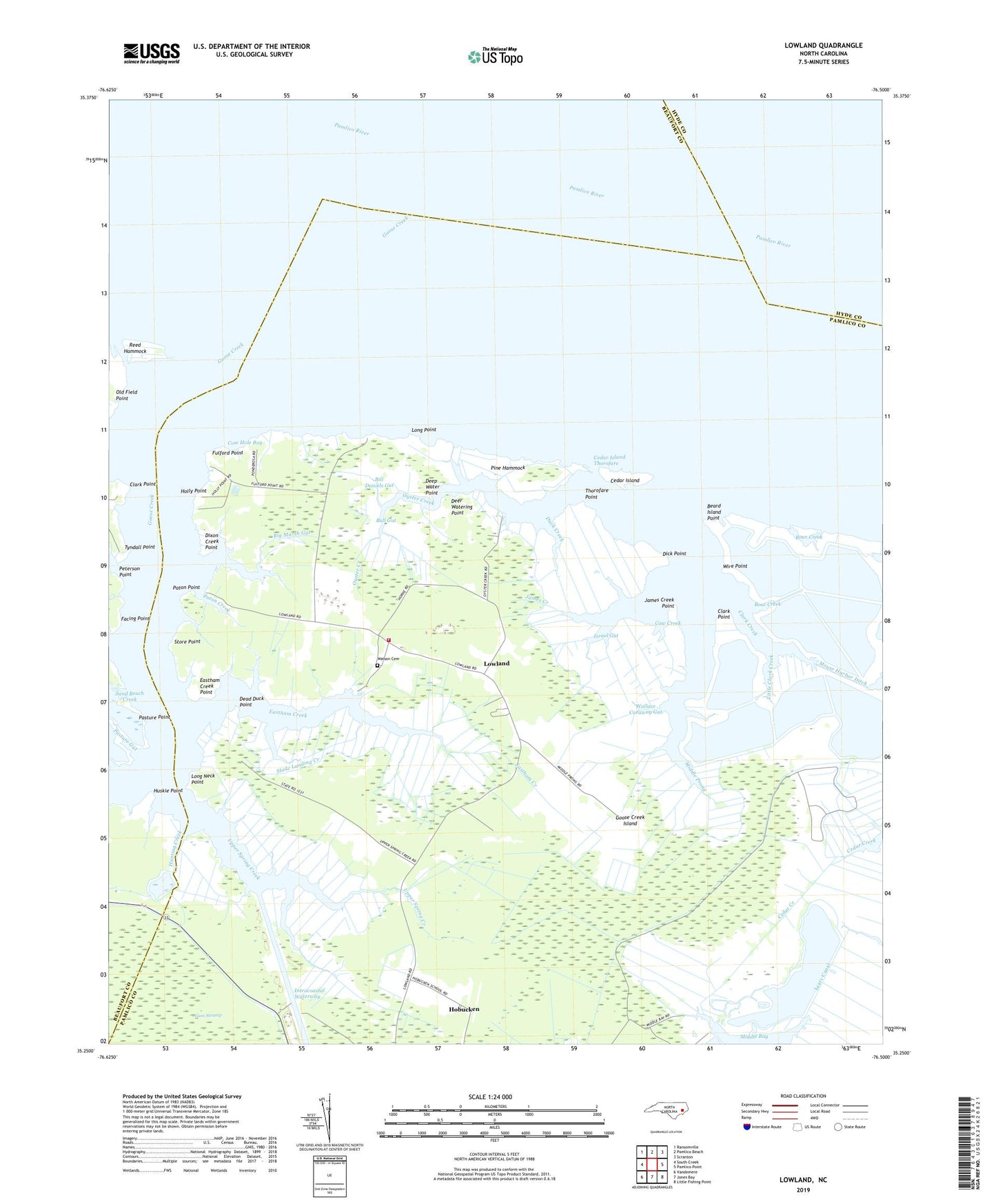
2022 topographic map quadrangle Lowland in the state of North Carolina. Scale: 1:24000. Based on the newly updated USGS 7.5' US Topo map series, this map is in the following counties: Pamlico, Beaufort, Hyde. The map contains contour data, water features, and other items you are used to seeing on USGS maps, but also has updated roads and other features. This is the next generation of topographic maps. Printed on high-quality waterproof paper with UV fade-resistant inks.
Quads adjacent to this one:
West: South Creek
Northwest: Ransomville
North: Pamlico Beach
Northeast: Scranton
East: Pamlico Point
Southeast: Little Fishing Point
South: Jones Bay
Southwest: Vandemere
This map covers the same area as the classic USGS quad with code o35076c5.
Contains the following named places: Alligator Creek, Antioch Church, Beard Island Point, Big Marsh Gut, Bill Daniels Gut, Boar Creek, Boat Creek, Bull Gut, Campbell Creek, Capp Creek, Caraway Landing, Cedar Island, Cedar Island Thorofare, Clark Creek, Clark Point, Convoy Gut, Cow Creek, Cow Gallus Creek, Cow Hole Bay, Dead Duck Point, Deep Water Point, Deer Watering Point, Dick Point, Dixon Creek, Dixon Creek Point, Duck Creek, Eastham Creek, Eastham Creek Point, Facing Point, Fulford Point, Goose Creek, Goose Creek Island, Goose Creek Island Volunteer Fire Department, Hobucken Census Designated Place, Holly Point, Horse Island Creek, Hunting Creek, Huskie Point, Israel Gut, James Creek, James Creek Point, Leary Canal, Little Clark Creek, Long Creek, Long Neck Point, Long Point, Lower Spring Creek, Lowland, Mallard Creek, Middle Prong, Mill Seat Landing, Mouse Harbor Ditch, Mud Gut, Old Field Point, Otter Creek, Oyster Creek, Pasture Gut, Pasture Point, Paton Creek, Paton Point, Pentecostal Church, Peterson Creek, Peterson Point, Pine Hammock, Reed Hammock, Reed Hammock Ditch, River Ditch, Sampson Landing Creek, Sand Beach Creek, Shiloh Church, Slade Landing Creek, Snode Creek, Store Point, Thorofare Point, Tyndall Point, Upper Spring Creek, Wallace Caraway Gut, Warden Grove Church, Watson Cemetery, Whealton Ferry, Wilkerson Creek, Wire Point, ZIP Code: 28552