MyTopo
Seagrove North Carolina US Topo Map
Couldn't load pickup availability
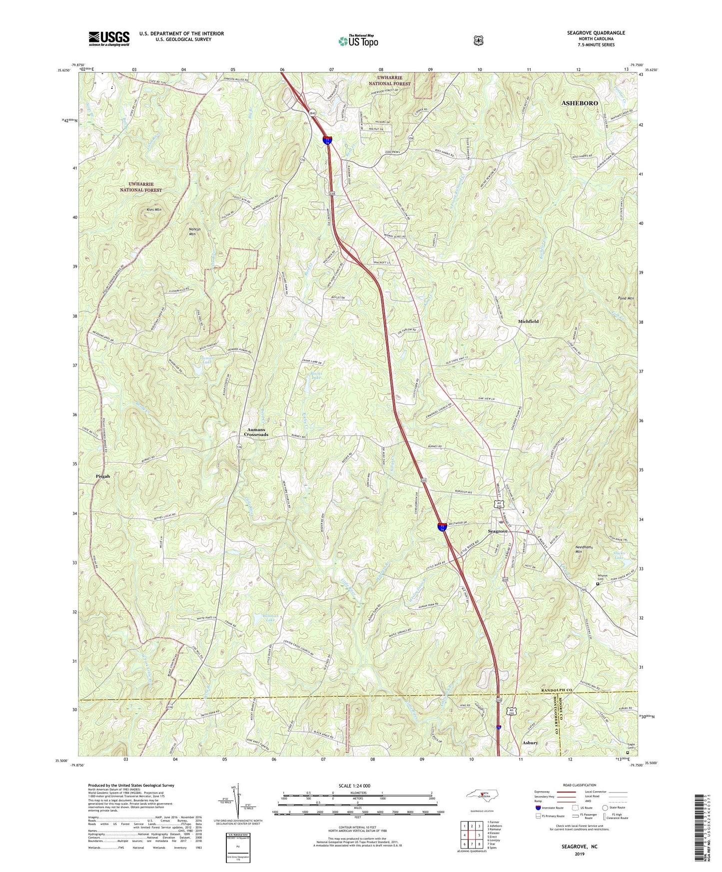
2019 topographic map quadrangle Seagrove in the state of North Carolina. Scale: 1:24000. Based on the newly updated USGS 7.5' US Topo map series, this map is in the following counties: Randolph, Montgomery, Moore. The map contains contour data, water features, and other items you are used to seeing on USGS maps, but also has updated roads and other features. This is the next generation of topographic maps. Printed on high-quality waterproof paper with UV fade-resistant inks.
Quads adjacent to this one:
West: Eleazer
Northwest: Farmer
North: Asheboro
Northeast: Ramseur
East: Erect
Southeast: Spies
South: Star
Southwest: Lovejoy
Contains the following named places: Antioch Church, Asheworth Branch, Auman Lake, Auman Lake Dam, Aumans Crossroads, Bell Branch, Big Branch, Big Oak Christian Church, Black Ankle, Blacks Lake, Blacks Lake Dam, Cagle Cemetery, Center Cross Church, Emmanuel Church, Fairview Church, Flag Springs Church, Fulp Church, Huldah Church, Hurley Lake, Hurley Lake Dam, Kies Mountain, Kings Creek, Maple Springs Church, Michfield, Mitchell Church, Nancys Mountain, Needhams Mountain, New Hope Church, Pisgah, Pisgah Church, Pleasant Hill Church, Reed Creek, Reedy Creek, Rocky Creek, Scott Branch, Seagrove, Seagrove Elementary School, Seagrove Post Office, Seagrove Rural Volunteer Fire Department, Slacks Lake, Slacks Lake Dam, South Prong Little River, Southwestern Randolph High School, Town of Seagrove, Township of Union, Wagners Branch, Wesley Dean Branch, Whynot, Whynot Cemetery, Wimbish Lake, Wimbish Lake Dam