MyTopo
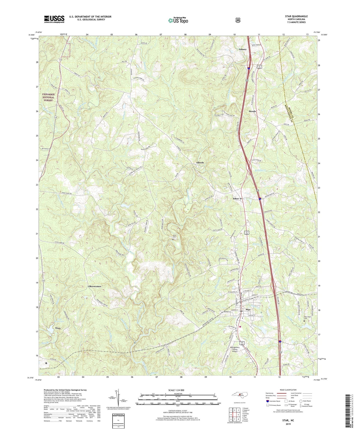
Star North Carolina US Topo Map
Couldn't load pickup availability
Also explore the Star Forest Service Topo of this same quad for updated USFS data
2022 topographic map quadrangle Star in the state of North Carolina. Scale: 1:24000. Based on the newly updated USGS 7.5' US Topo map series, this map is in the following counties: Montgomery, Moore. The map contains contour data, water features, and other items you are used to seeing on USGS maps, but also has updated roads and other features. This is the next generation of topographic maps. Printed on high-quality waterproof paper with UV fade-resistant inks.
Quads adjacent to this one:
West: Lovejoy
Northwest: Eleazer
North: Seagrove
Northeast: Erect
East: Spies
Southeast: Candor
South: Biscoe
Southwest: Troy
This map covers the same area as the classic USGS quad with code o35079d7.
Contains the following named places: Allen Cemetery, Allreds, Asbury, Asbury Church, Barnes Mill Creek, Betsy Branch, Black Ankle Mine, Black Rock Branch, Dicks Creek, Emergency Medical Rescue Squad, Ether, Ether Post Office, Forks of Little River Church, Foster Pond, Foster Pond Dam, Gold Mine Branch, Green Grove Church, Hughs Creek, Lick Creek, Montgomery County Airport, New Hope Cemetery, New Hope Church, Nichols Run, Okeewemee, Ott Lake, Ott Lake Dam, Rocky Creek, Shady Grove Church, Southern Correctional Institution, Star, Star Fire Department, Star Middle School, Star Police Department, Star Post Office, Steeds, Suck Branch, Suggs Creek, Suggs Creek Church, Town of Star, Township of Little River, Township of Star, Troy Reservoirs, Troy Reservoirs Dam, Wards Creek, West Fork Little River, White Oak Creek, White Oak Springs Church, ZIP Code: 27356