MyTopo
Shepherds North Carolina US Topo Map
Couldn't load pickup availability
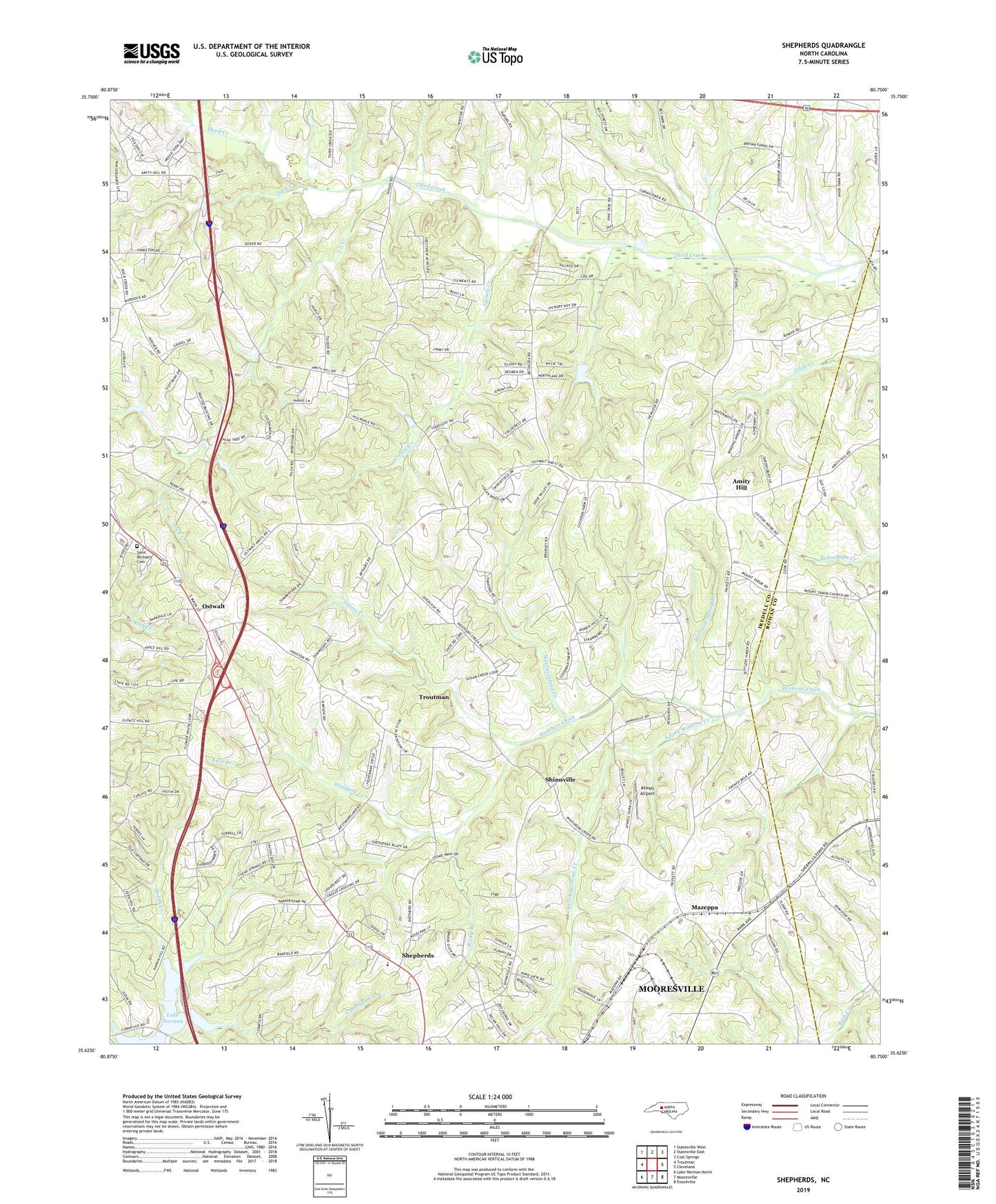
2019 topographic map quadrangle Shepherds in the state of North Carolina. Scale: 1:24000. Based on the newly updated USGS 7.5' US Topo map series, this map is in the following counties: Iredell, Rowan. The map contains contour data, water features, and other items you are used to seeing on USGS maps, but also has updated roads and other features. This is the next generation of topographic maps. Printed on high-quality waterproof paper with UV fade-resistant inks.
Quads adjacent to this one:
West: Troutman
Northwest: Statesville West
North: Statesville East
Northeast: Cool Springs
East: Cleveland
Southeast: Enochville
South: Mooresville
Southwest: Lake Norman North
Contains the following named places: Amity Church, Amity Hill, Amity Hills Farm, Amity School, Atwell Airport, Bethesda Church, Beulah Heights Church, Duck Creek, Greasy Creek, Hobbs Creek, I-L Creek, J C Murdock Dam, J C Neely Dam, Kerr Branch, Mazeppa, Morrison Spring Branch, New Parrot Home Church, Noname, Oak Grove Church, Ostwalt, Rocky Branch, Saint James Church, Saint Michaels Cemetery, Shady Grove Church, Shepherds, Shepherds Church, Shiloh Presbyterian Church, Shinns Creek, Shinnville, Shinnville Church, Smiths Chapel, South Fork Withrow Creek, Third Creek Sewage Treatment Plant, Township of Barringer, Triplett Church, Vanderburg Church, Weathers Creek, Wesley Chapel, Westmoreland Creek, ZIP Code: 28166