MyTopo
Silver Hill North Carolina US Topo Map
Couldn't load pickup availability
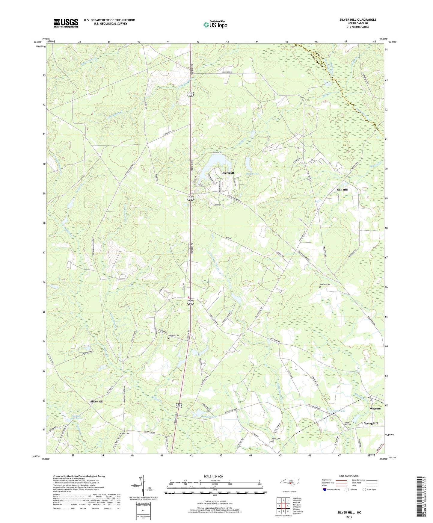
2019 topographic map quadrangle Silver Hill in the state of North Carolina. Scale: 1:24000. Based on the newly updated USGS 7.5' US Topo map series, this map is in the following counties: Scotland, Hoke. The map contains contour data, water features, and other items you are used to seeing on USGS maps, but also has updated roads and other features. This is the next generation of topographic maps. Printed on high-quality waterproof paper with UV fade-resistant inks.
Quads adjacent to this one:
West: Marston
Northwest: Hoffman
North: Pinebluff
Northeast: McCain
East: Wagram
Southeast: Wakulla
South: Laurinburg
Southwest: Gibson
Contains the following named places: Beaver Dam Creek, Cooley's Nursery, Davis Cemetery, Deercroft Census Designated Place, Dixie Pond, Dixie Pond Dam, Dogwood Farms, East Prong Juniper Creek, Hills Creek, Little Creek, McNeill Cemetery, Monroe Mill Pond, Mountain Creek, Naomi Church, Nashville Church, Nashville School, Newtons Pond, Newtons Pond Dam, Oak Hill, Saint Peters Church, Shaw High School, Silver Hill, Slates Memorial Church, Smith Pond, Spring Branch Church, Spring Hill, Spring Hill - Friendship Fire Department, Spring Hill Cemetery, Township of Spring Hill, West Prong Juniper Creek, Wilkes Branch, Wrights Cemetery, ZIP Code: 28396