MyTopo
Singletary Lake North Carolina US Topo Map
Couldn't load pickup availability
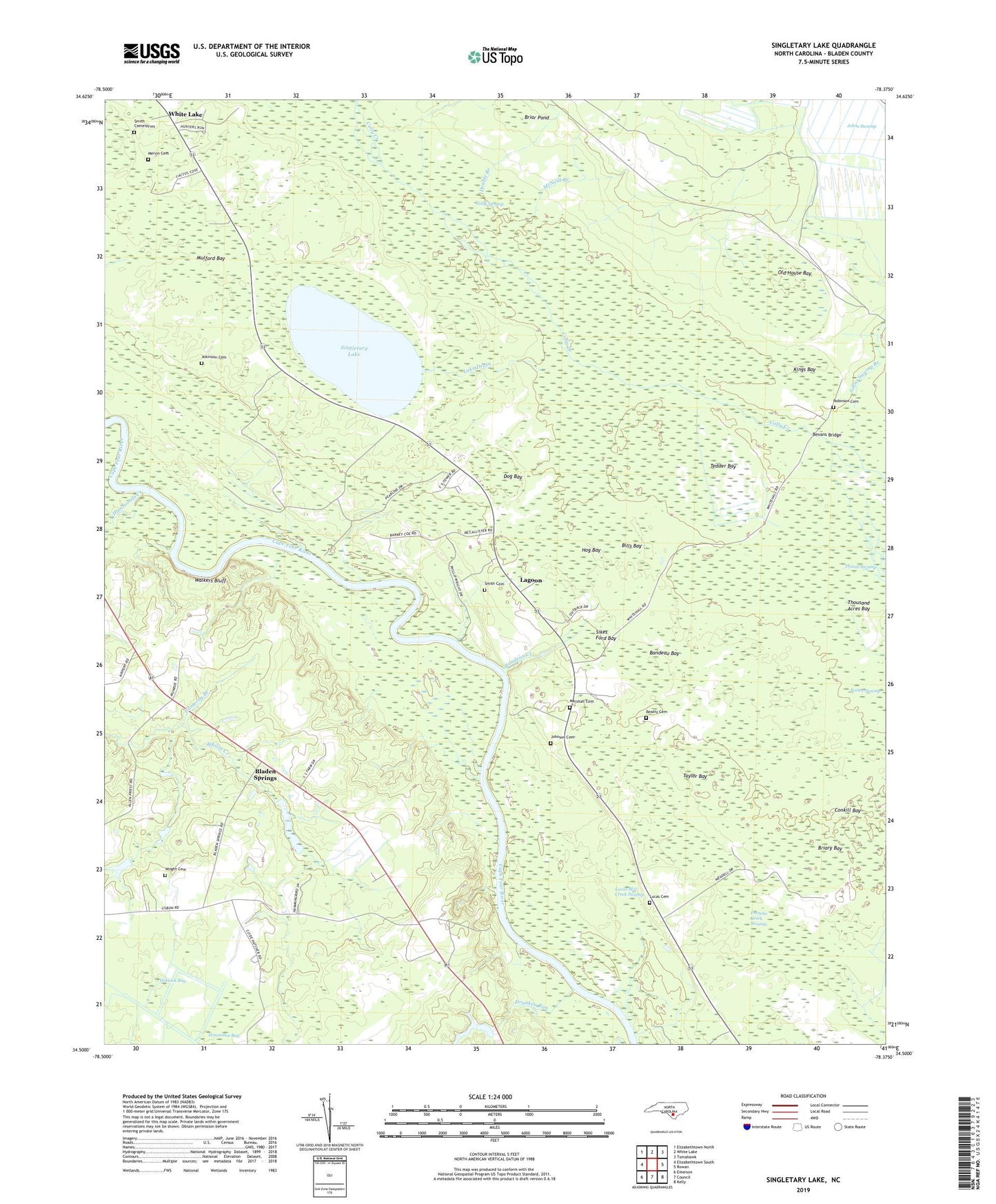
2019 topographic map quadrangle Singletary Lake in the state of North Carolina. Scale: 1:24000. Based on the newly updated USGS 7.5' US Topo map series, this map is in the following counties: Bladen. The map contains contour data, water features, and other items you are used to seeing on USGS maps, but also has updated roads and other features. This is the next generation of topographic maps. Printed on high-quality waterproof paper with UV fade-resistant inks.
Quads adjacent to this one:
West: Elizabethtown South
Northwest: Elizabethtown North
North: White Lake
Northeast: Tomahawk
East: Rowan
Southeast: Kelly
South: Council
Southwest: Emerson
Contains the following named places: Atkinson Cemetery, Atkinson Landing, Bandeau Bay, Bandeau Creek, Beatty Cemetery, Bevans Bridge, Bevans Chapel, Bills Bay, Bladen Springs, Briar Pond, Briary Bay, Cameron Branch, Coal Mine Landing, Colly Swamp, Dog Bay, Double Branch, Drunken Run, Frenchs Creek Swamp, Gibson Landing, Group Camp, Hammonds Creek, Hattock Bay, Hog Bay, Jessups Landing, Johns Swamp, Johns Swamp Branch, Johnson Cemetery, Kates Chapel, Kings Bay, Lagoon, Lake Drain, Lock Landing, Lucas Cemetery, Lucas Mill Creek Swamp, Marsh Branch, Marshall Cemetery, McNeill Branch, Melvin Cemetery, Mount Horeb Church, Mulford Bay, New Zion Church, Old House Bay, Porter Swamp, Robinson Cemetery, Russ Landing, Sikes Ford Bay, Singletary Lake, Singletary Lake State Park, Smith Cemeteries, Smith Cemetery, Taylor Bay, Tedder Bay, Thousand Acres Bay, Thumb Swamp, Walkers Bluff, WECT-TV (Wilmington), Whitehall Landing, Wright Cemetery, Zion Chapel