MyTopo
Stantonsburg North Carolina US Topo Map
Couldn't load pickup availability
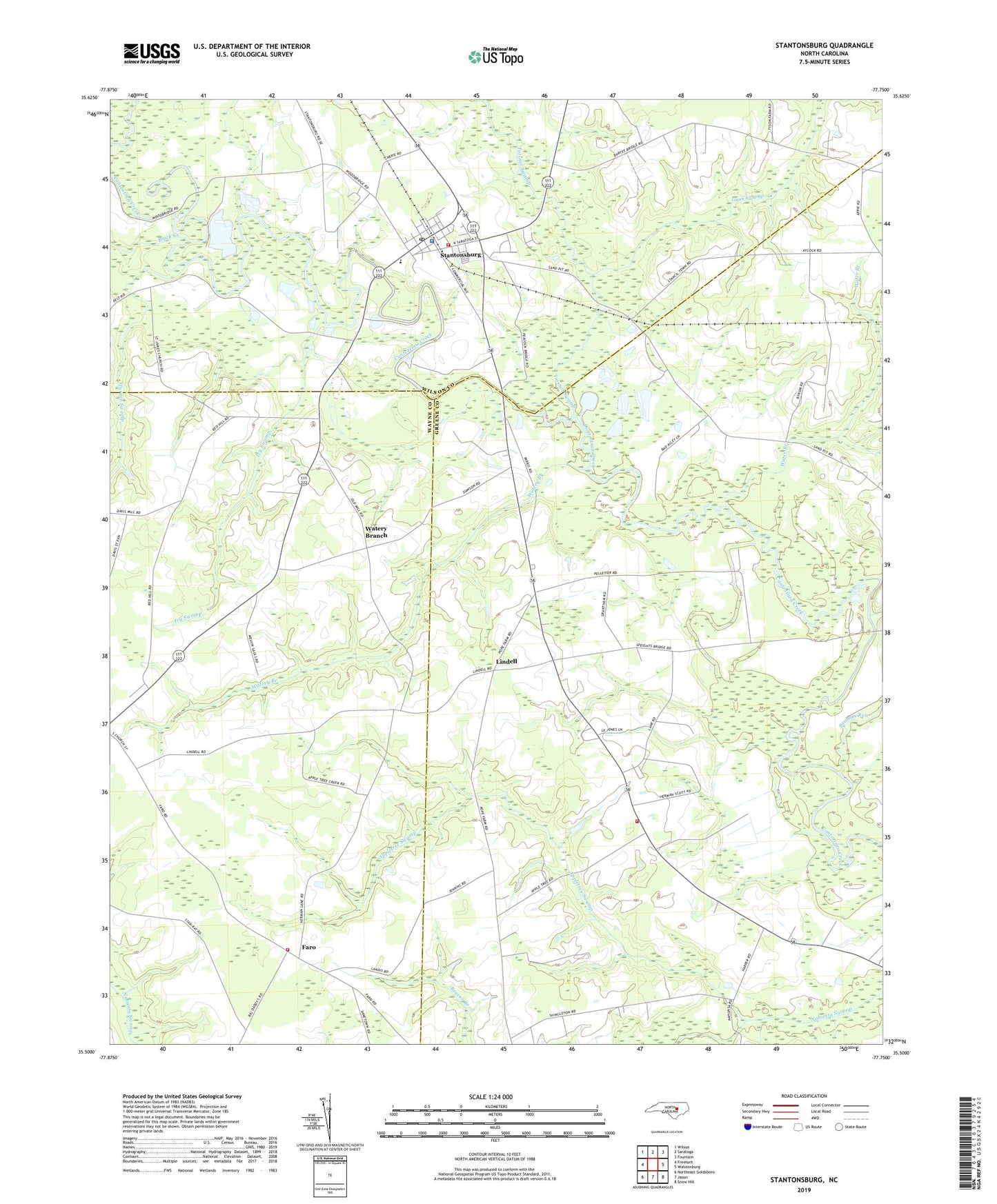
2019 topographic map quadrangle Stantonsburg in the state of North Carolina. Scale: 1:24000. Based on the newly updated USGS 7.5' US Topo map series, this map is in the following counties: Greene, Wayne, Wilson. The map contains contour data, water features, and other items you are used to seeing on USGS maps, but also has updated roads and other features. This is the next generation of topographic maps. Printed on high-quality waterproof paper with UV fade-resistant inks.
Quads adjacent to this one:
West: Fremont
Northwest: Wilson
North: Saratoga
Northeast: Fountain
East: Walstonburg
Southeast: Snow Hill
South: Jason
Southwest: Northeast Goldsboro
Contains the following named places: Appletree Swamp, Beaman Run, Black Creek, Bull Head Rural Volunteer Fire Department, Diggs Chapel, Eureka Elementary School, Faith Church, Faro, Faro Volunteer Fire Department - Northeast Station 1, Goss Swamp, Greater Zion Church, Ivy Swamp, Lebanon Church, Levelton Chapel, Lindell, Miracle Church, Mount Calvary Church, Saint James Church, Saint Lukes Church, Salisbury Church, Stantonsburg, Stantonsburg Elementary School, Stantonsburg Emergency Medical Services, Stantonsburg Moyton Volunteer Fire Department Station 3, Stantonsburg Police Department, Stantonsburg Post Office, Toisnot Swamp, Town of Stantonsburg, Township of Bull Head, Travelers Rest Church, Turner Swamp, Union Grove Church, Water Branch, Watery Branch, Yelverton Church, ZIP Code: 27883