MyTopo
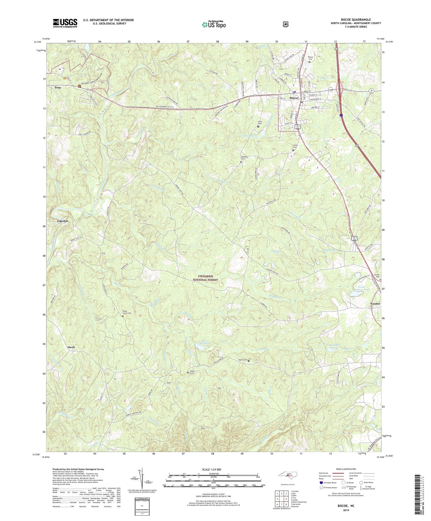
Biscoe North Carolina US Topo Map
Couldn't load pickup availability
Also explore the Biscoe Forest Service Topo of this same quad for updated USFS data
2022 topographic map quadrangle Biscoe in the state of North Carolina. Scale: 1:24000. Based on the newly updated USGS 7.5' US Topo map series, this map is in the following counties: Montgomery. The map contains contour data, water features, and other items you are used to seeing on USGS maps, but also has updated roads and other features. This is the next generation of topographic maps. Printed on high-quality waterproof paper with UV fade-resistant inks.
Quads adjacent to this one:
West: Troy
Northwest: Lovejoy
North: Star
Northeast: Spies
East: Candor
Southeast: Norman
South: Harrisville
Southwest: Mount Gilead East
This map covers the same area as the classic USGS quad with code o35079c7.
Contains the following named places: Big Branch, Big Creek, Biscoe, Biscoe Cemetery, Biscoe Elementary School, Biscoe Fire Department, Biscoe Police Department, Biscoe Post Office, Blake Cemetery, Bridgers Creek, Candor Cemetery, Capelsie, Capelsie Lake, Capelsie Lake Dam, Cedar Creek, Community Church, Densons Creek, East Montgomery High School, First Health of the Carolinas Emergency Medical Services Base 3, Gillis Branch, Gillis Cemetery, Gold Branch, Half Mile Branch, Hickory Branch, Hickory Grove Church, Hood Chapel, Laurel Hill Church, Lewis Cemetery, Lewis Mill Pond, Lewis Millpond Dam, Little Creek, Little Dry Creek, Macedonia Church, McCullums Pond, Montgomery Technical Institute, Mount Moriah Church, Muddy Branch, Muddy Creek, Munn Cemetery, Onvil, Parson Brothers Pond, Parson Brothers Pond Dam, Parsons Grove Church, Piney Grove Cemetery, Reedy Fork, Rock Branch, Sams Creek, Sedberry Cemetery, Smitherman Mill Pond, Smitherman Millpond Dam, Southside Church, Spencer Branch, Taylor Branch, Town of Biscoe, Township of Biscoe, Turkey Creek, Uwharrie National Forest Station, Valley Grove Church, White Oak Creek, WJRM-AM (Troy), ZIP Codes: 27209, 27229