MyTopo
Summerlins Crossroads North Carolina US Topo Map
Couldn't load pickup availability
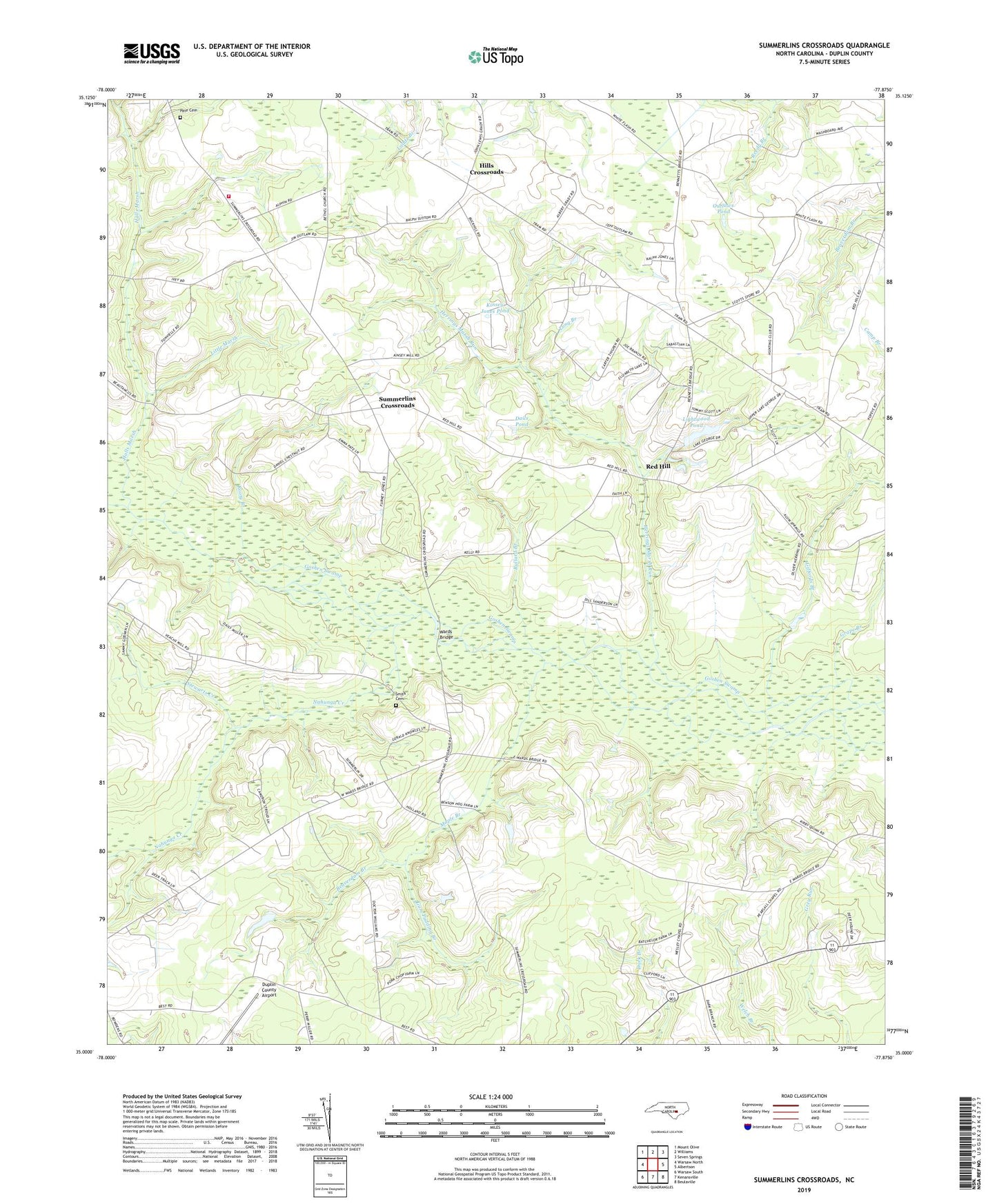
2019 topographic map quadrangle Summerlins Crossroads in the state of North Carolina. Scale: 1:24000. Based on the newly updated USGS 7.5' US Topo map series, this map is in the following counties: Duplin. The map contains contour data, water features, and other items you are used to seeing on USGS maps, but also has updated roads and other features. This is the next generation of topographic maps. Printed on high-quality waterproof paper with UV fade-resistant inks.
Quads adjacent to this one:
West: Warsaw North
Northwest: Mount Olive
North: Williams
Northeast: Seven Springs
East: Albertson
Southeast: Beulaville
South: Kenansville
Southwest: Warsaw South
Contains the following named places: Alum Springs Church, Beaverdam Branch, Bethel Methodist Church, Branchs Store Post Office, Brocks Chapel, Bullard Branch, Calvary Church, Dails Pond, Duplin County Airport, Giffords Branch, Grape Branch, Grayfield Mobile Home Park, Gum Pudding Branch, Halls Marsh, Herrings Marsh Run, Hills Crossroads, Kinsey Jones Pond, Lightwood Pond, Little Marsh, Long Branch, Long Ridge Church, Maple Branch, McGowen Post Office, Nahunga Creek, Oak Wolfe Fire Department, Outlaws Pond, Pate Cemetery, Pearsall Chapel, Pearsall Post Office, Piney Green Church, Red Hill, Reedy Branch, Rooty Branch, Rooty Branch Church, Saint Stephen Church, Scotts Store, Smith Cemetery, Smith Chapel, Snow Hill Church, Stewarts Creek, Summerlins Crossroads, Sutton Chapel, Township of Glisson, Wards Bridge, Welch Branch, Wesley Methodist Church, Westbrook Crossroads