MyTopo
Warsaw South North Carolina US Topo Map
Couldn't load pickup availability
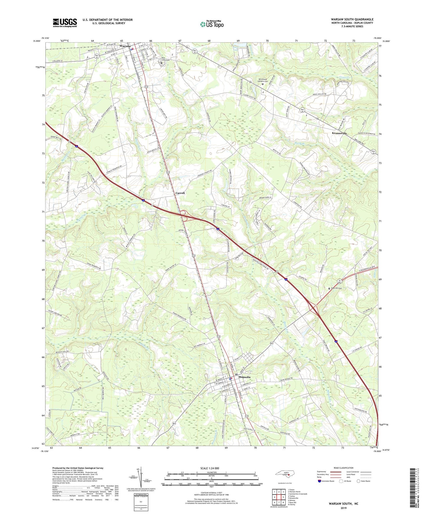
2022 topographic map quadrangle Warsaw South in the state of North Carolina. Scale: 1:24000. Based on the newly updated USGS 7.5' US Topo map series, this map is in the following counties: Duplin. The map contains contour data, water features, and other items you are used to seeing on USGS maps, but also has updated roads and other features. This is the next generation of topographic maps. Printed on high-quality waterproof paper with UV fade-resistant inks.
Quads adjacent to this one:
West: Turkey
Northwest: Faison
North: Warsaw North
Northeast: Summerlins Crossroads
East: Kenansville
Southeast: Charity
South: Rose Hill
Southwest: Delway
This map covers the same area as the classic USGS quad with code o34078h1.
Contains the following named places: Beasleys Millpond, Carlton Methodist Chapel, Carroll, Carroll Street Pentecostal Free Will Baptist Church, Devotional Gardens Cemetery, Douglass Junior High School, Duplin County Emergency Medical Services Medic 1, Hines Chapel, James Kenan High School, Johnson Church, Magnolia, Magnolia Police Department, Magnolia Post Office, Magnolia Volunteer Fire Department, Magnolia Wastewater Treatment Plant, Mount Calvary Church, Pine Crest Cemetery, Rainbow Chapel, Rose Hill Funeral Home Cemetery, Saint Peter Church, Saint Stephens Church, Silver Lake, Taylor Field, Town of Magnolia, Town of Warsaw, Township of Magnolia, Township of Warsaw, Warsaw, Warsaw Elementary School, Warsaw Fire Department, Warsaw Police Department, Warsaw Wastewater Treatment Plant, West Duplin Church, Williams School, ZIP Codes: 28398, 28453