MyTopo
Kenansville North Carolina US Topo Map
Couldn't load pickup availability
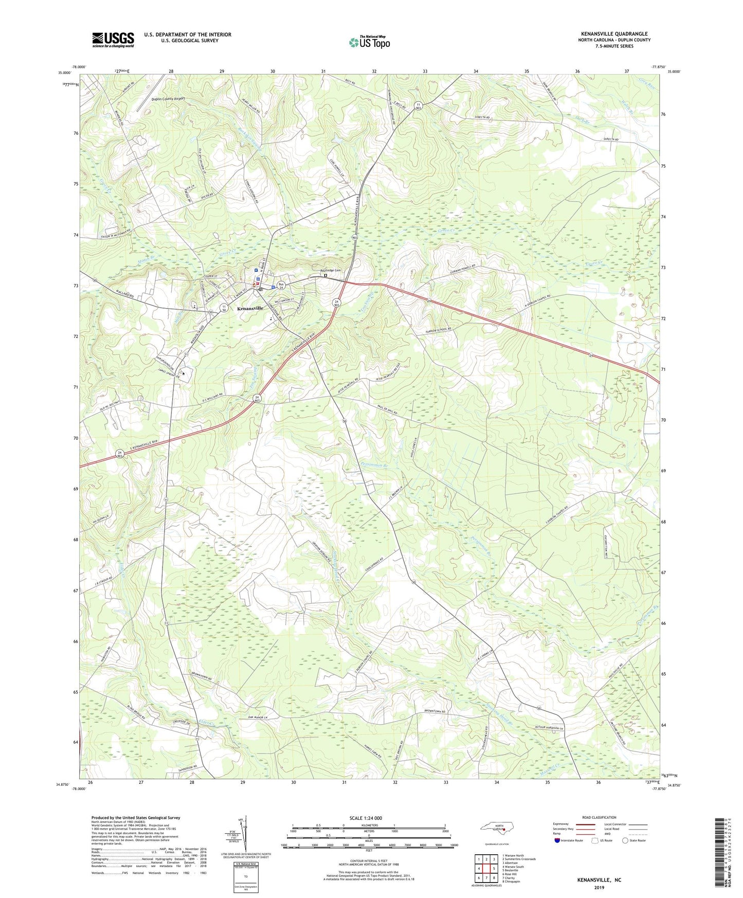
2022 topographic map quadrangle Kenansville in the state of North Carolina. Scale: 1:24000. Based on the newly updated USGS 7.5' US Topo map series, this map is in the following counties: Duplin. The map contains contour data, water features, and other items you are used to seeing on USGS maps, but also has updated roads and other features. This is the next generation of topographic maps. Printed on high-quality waterproof paper with UV fade-resistant inks.
Quads adjacent to this one:
West: Warsaw South
Northwest: Warsaw North
North: Summerlins Crossroads
Northeast: Albertson
East: Beulaville
Southeast: Chinquapin
South: Charity
Southwest: Rose Hill
This map covers the same area as the classic USGS quad with code o34077h8.
Contains the following named places: Big Zion Church, Buckskin Swamp, Dobson Chapel, Duplin Correctional Center, Duplin County, Duplin County Emergency Medical Services Medic 8, Duplin County Library - Dorothy Wightman Branch, Duplin County Sheriff's Office, E E Smith Middle, Elders Chapel, First Baptist Church, Grove Church, James Sprunt Community College, Kenansville, Kenansville Baptist Church, Kenansville Courthouse, Kenansville Elementary School, Kenansville Fire Department, Kenansville Police Department, Kenansville Post Office, Marsh Branch, Maxwell Creek, Mill Branch, North Carolina State Highway Patrol Troop B District 4, Pearsall Chapel, Pineview Mobile Home Park, Routledge Cemetery, Sarecta Chapel, Tea Swamp, Town of Kenansville, Township of Kenansville, United Church, Vidant Duplin Hospital, ZIP Code: 28349