MyTopo
Turkey North Carolina US Topo Map
Couldn't load pickup availability
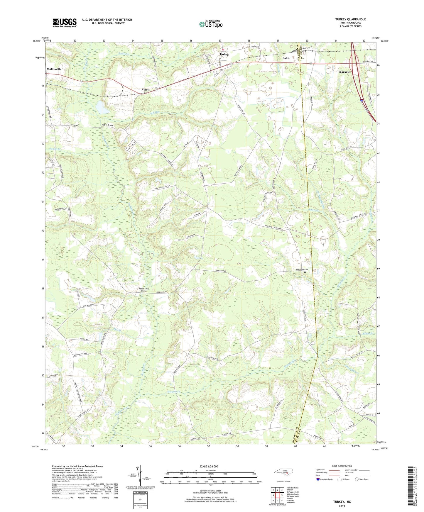
2019 topographic map quadrangle Turkey in the state of North Carolina. Scale: 1:24000. Based on the newly updated USGS 7.5' US Topo map series, this map is in the following counties: Sampson, Duplin. The map contains contour data, water features, and other items you are used to seeing on USGS maps, but also has updated roads and other features. This is the next generation of topographic maps. Printed on high-quality waterproof paper with UV fade-resistant inks.
Quads adjacent to this one:
West: Clinton South
Northwest: Clinton North
North: Faison
Northeast: Warsaw North
East: Warsaw South
Southeast: Rose Hill
South: Delway
Southwest: Ingold
Contains the following named places: Bakers Branch, Baltic, Buckhall Creek, Bull Branch, Carltons Mill Run, Elliott, Holly Grove Church, House of Prayer Church, Kirbys Bridge, Mill Run, Millers Creek, Mount Pleasant Church, New Hope Cemetery, New Hope Church, Piney Grove Church, Reeds Ford Bridge, Rowan Branch, Saint Stephens Church, Sikes Mill Run, Stewart Creek School, Stewarts Creek, Town of Turkey, Township of Turkey, Turkey, Turkey Creek, Turkey Post Office, Turkey Volunteer Fire Department, Wilson Chapel, Yam Yankees Airport, ZIP Code: 28393