MyTopo
White Cross North Carolina US Topo Map
Couldn't load pickup availability
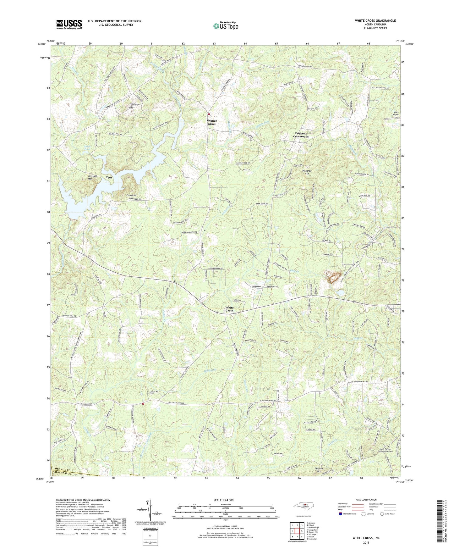
2019 topographic map quadrangle White Cross in the state of North Carolina. Scale: 1:24000. Based on the newly updated USGS 7.5' US Topo map series, this map is in the following counties: Orange, Chatham, Alamance. The map contains contour data, water features, and other items you are used to seeing on USGS maps, but also has updated roads and other features. This is the next generation of topographic maps. Printed on high-quality waterproof paper with UV fade-resistant inks.
Quads adjacent to this one:
West: Saxapahaw
Northwest: Mebane
North: Efland
Northeast: Hillsborough
East: Chapel Hill
Southeast: Farrington
South: Bynum
Southwest: Silk Hope
Contains the following named places: Alston Grove Church, Antioch Church, Apple Pond, Bethel Church, Cane Creek Church, Chapel Hill Quarry, Clover Garden Church, Crawford Mountain, Dodsons Crossroads, Hickory Grove Church, Hog Branch, Hudson Branch, Judea Reform Congregation Cemetery, Miles Airport, Mitchell Mountain, Neville Airport, Orange Chapel, Orange Grove, Orange Grove Volunteer Fire Company, Pickards Mountain, Teer, Terrells Creek Church, Thompson Mountain, Toms Creek, Township of Bingham, Turkey Hill Creek, Watery Fork, White Cross, White Cross Volunteer Fire Department, Wildcat Branch, ZIP Code: 27516