MyTopo
Mebane North Carolina US Topo Map
Couldn't load pickup availability
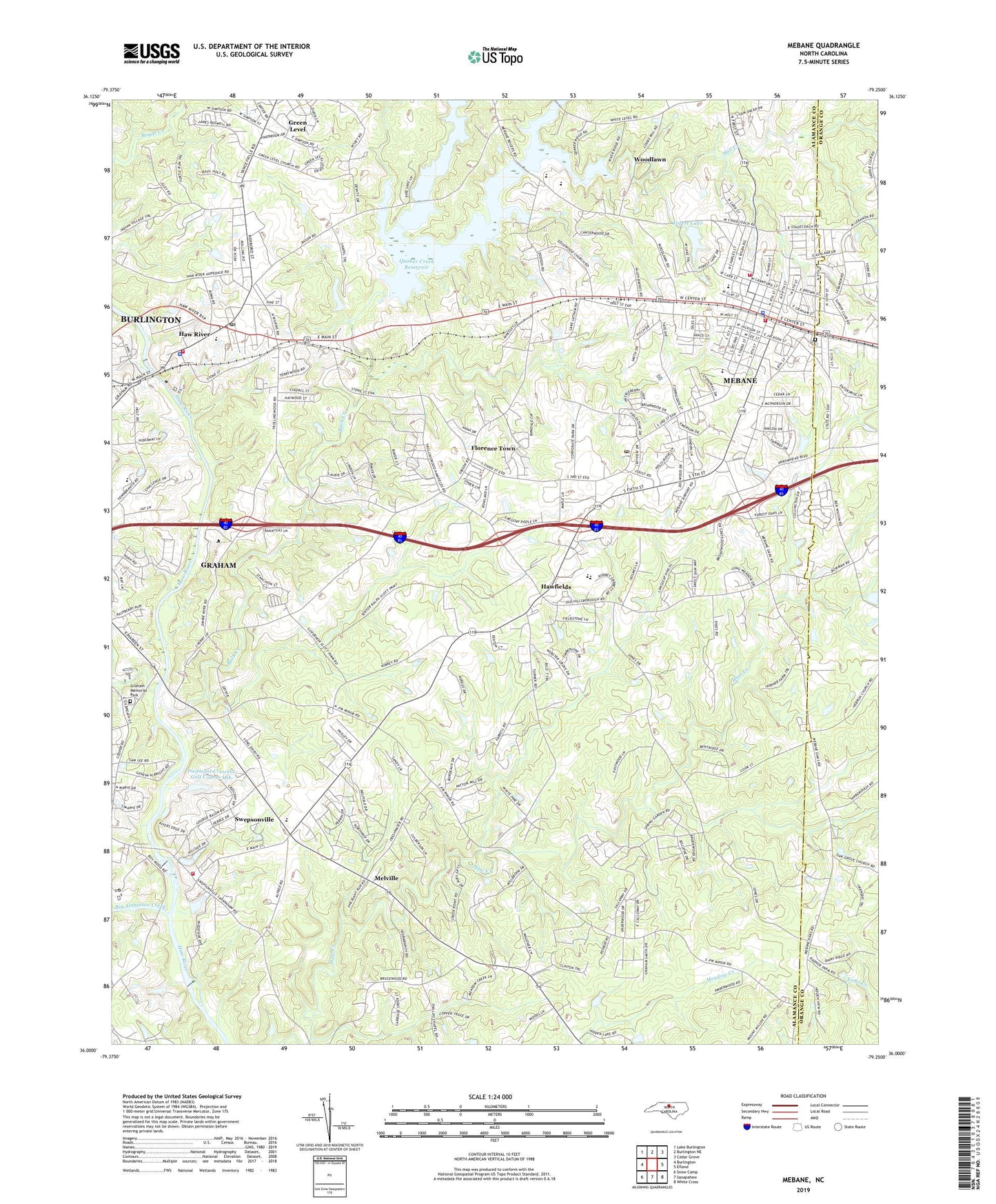
2022 topographic map quadrangle Mebane in the state of North Carolina. Scale: 1:24000. Based on the newly updated USGS 7.5' US Topo map series, this map is in the following counties: Alamance, Orange. The map contains contour data, water features, and other items you are used to seeing on USGS maps, but also has updated roads and other features. This is the next generation of topographic maps. Printed on high-quality waterproof paper with UV fade-resistant inks.
Quads adjacent to this one:
West: Burlington
Northwest: Lake Burlington
North: Burlington NE
Northeast: Cedar Grove
East: Efland
Southeast: White Cross
South: Saxapahaw
Southwest: Snow Camp
This map covers the same area as the classic USGS quad with code o36079a3.
Contains the following named places: Alamance Community College, Arrowhead Golf Club, Back Creek, Belview Church, Big Alamance Creek, Brook Hollow, Buena Vista Estates, City of Mebane, Cooper Estates, Eastern High School, Eastern Middle School, Eastside Church, Edgewood Church, Florence Town, Forest Lake, Forest Lake Dam, Graham City Lake Number Two, Graham City Lake Number Two Dam, Graham Lake, Graham Memorial Park, Granite Village, Green Level, Green Level Church, Haw River, Haw River Elementary School, Haw River Fire Department, Haw River Park, Haw River Police Department, Haw River Post Office, Hawfields, Hawfields Church, Hawfields United Church, Hebron Church, Hurdle Field, Kimrey Airport, Lakeview Acres, Latham Lake, Mebane, Mebane Fire Department North Side Station, Mebane Fire Department South Side Station, Mebane Police Department, Mebane Post Office, Melville, Mill Creek, Oakwood Cemetery, Philips Chapel, Piedmont Crescent Golf Course Lak, Quaker Creek, Quaker Creek Reservoir, Quarry Hills Country Club and Golf Course, Rice Airfarm, Riverside Church, Saint Lukes Church, South Mebane School, Stagecoach Trail, Swepsonville, Swepsonville Volunteer Fire Department Station 1, Technical College of Alamance, Town of Green Level, Town of Haw River, Town of Swepsonville, Township 10-Melville, Township 13-Haw River, Trinity Church, West End School, WHNI-AM (Mebane), Wilson School, Woodlawn, Woodlawn Census Designated Place, Yoder School, ZIP Code: 27258