MyTopo
Wilmar North Carolina US Topo Map
Couldn't load pickup availability
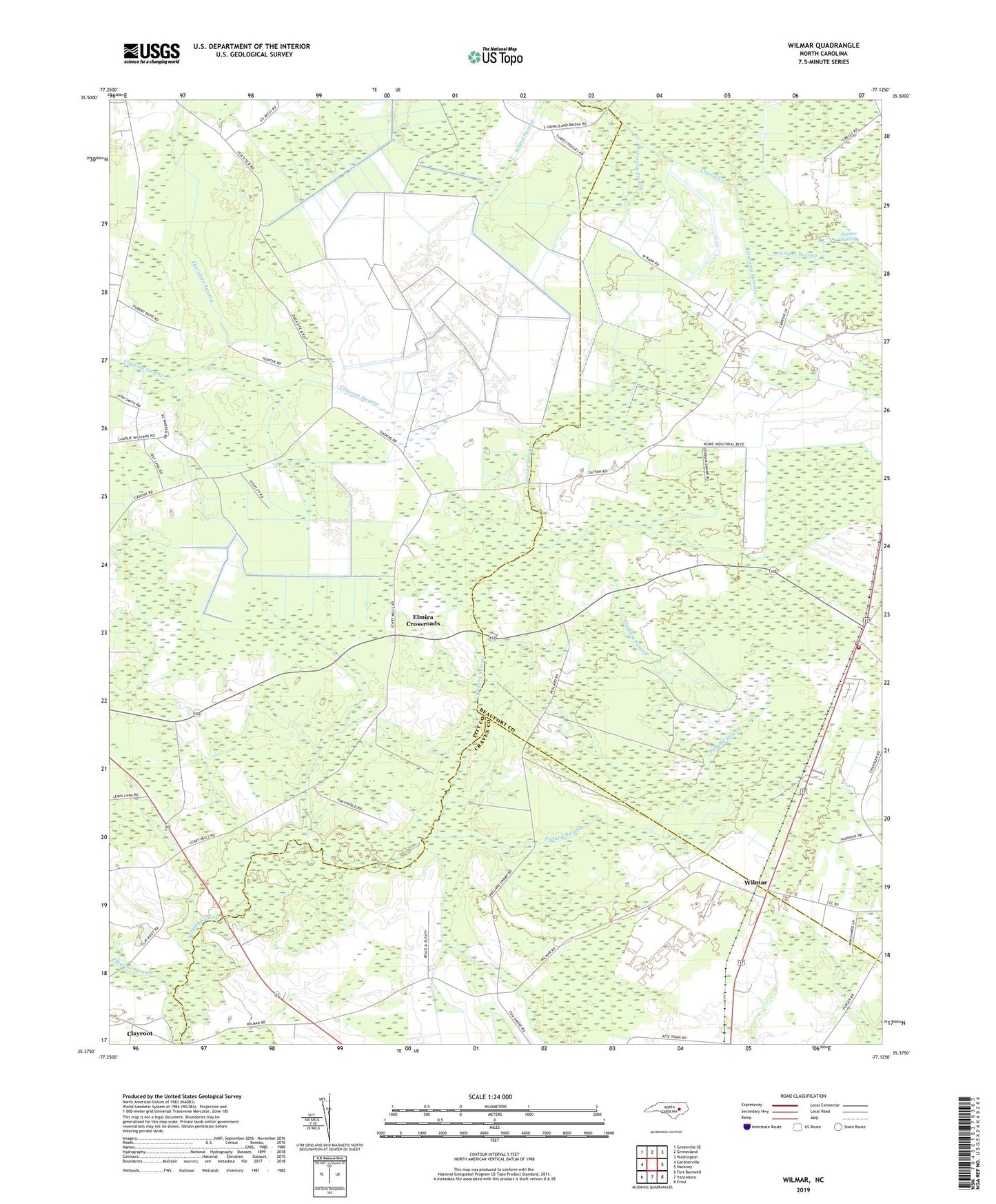
2019 topographic map quadrangle Wilmar in the state of North Carolina. Scale: 1:24000. Based on the newly updated USGS 7.5' US Topo map series, this map is in the following counties: Pitt, Beaufort, Craven. The map contains contour data, water features, and other items you are used to seeing on USGS maps, but also has updated roads and other features. This is the next generation of topographic maps. Printed on high-quality waterproof paper with UV fade-resistant inks.
Quads adjacent to this one:
West: Gardnerville
Northwest: Greenville SE
North: Grimesland
Northeast: Washington
East: Hackney
Southeast: Ernul
South: Vanceboro
Southwest: Fort Barnwell
Contains the following named places: Chapman Church, Chocowinity Fire Department Station 2 Wilmar Substation, Creeping Swamp, Elmira Crossroads, Gorham Swamp, Gorham Swamp Church, Harding Swamp, Horseway Swamp, Island Swamp, Joseph Branch Church, Juniper Swamp, Oak Grove Church, Polland Swamp, Tabernacle Church, The Opening, Thorofare Swamp, Vanguard Farms, Voice of America, Wilmar