MyTopo
Vanceboro North Carolina US Topo Map
Couldn't load pickup availability
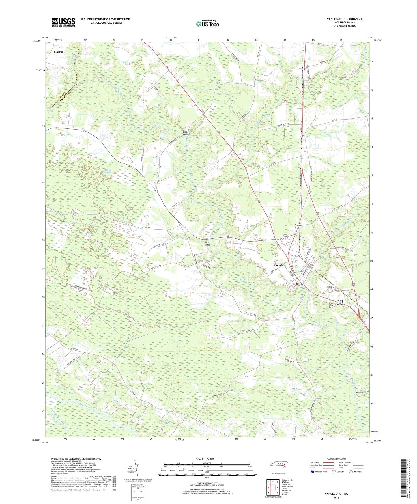
2022 topographic map quadrangle Vanceboro in the state of North Carolina. Scale: 1:24000. Based on the newly updated USGS 7.5' US Topo map series, this map is in the following counties: Craven, Pitt. The map contains contour data, water features, and other items you are used to seeing on USGS maps, but also has updated roads and other features. This is the next generation of topographic maps. Printed on high-quality waterproof paper with UV fade-resistant inks.
Quads adjacent to this one:
West: Fort Barnwell
Northwest: Gardnerville
North: Wilmar
Northeast: Hackney
East: Ernul
Southeast: Askin
South: Jasper
Southwest: Cove City
This map covers the same area as the classic USGS quad with code o35077c2.
Contains the following named places: Anderson Landing Strip, Baybush Swamp, Biddle Bridge, Celestial Memorial Gardens, Chapmans Church, Clayroot, Clayroot Swamp, Farm Life School, Folly Bridge, Fork Swamp, Heath Landing, Holly Hill Church, Ipock Landing, Juniper Chapel, Lane Landing, Lanes Church, Mauls Swamp, Palmeto Church, Palmetto Swamp, Queen Chapel, Reunion Chapel, Saint James Church, Saint Peters Church, Tabernacle Church, Town of Vanceboro, Township 1, Vanceboro, Vanceboro Landing, Vanceboro Police Department, Vanceboro Post Office, Vanceboro Rural Volunteer Fire Department, Vanceboro Rural Volunteer Fire Department and Rescue Squad, Vanceboro Wastewater Treatment Plant, West Craven High School, Wilkes Landing, ZIP Code: 28586