MyTopo
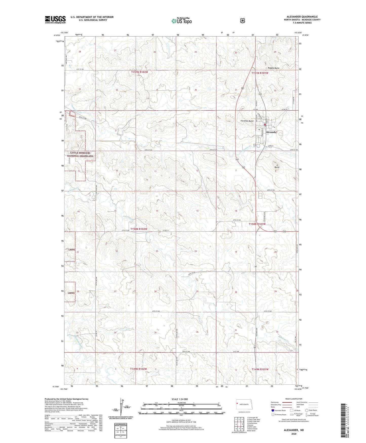
Alexander North Dakota US Topo Map
Couldn't load pickup availability
Also explore the Alexander Forest Service Topo of this same quad for updated USFS data
2024 topographic map quadrangle Alexander in the state of North Dakota. Scale: 1:24000. Based on the newly updated USGS 7.5' US Topo map series, this map is in the following counties: McKenzie. The map contains contour data, water features, and other items you are used to seeing on USGS maps, but also has updated roads and other features. This is the next generation of topographic maps. Printed on high-quality waterproof paper with UV fade-resistant inks.
Quads adjacent to this one:
West: Charbonneau
Northwest: Cartwright NE
North: Camp Creek West
Northeast: Camp Creek East
East: Rawson
Southeast: Bear Butte
South: Moline School
Southwest: Sather Lake
This map covers the same area as the classic USGS quad with code o47103g6.
Contains the following named places: A Butte, Alexander, Alexander City Hall, Alexander Police Department, Alexander Post Office, Alexander Public School, Alexander Volunteer Fire Department, City of Alexander, Foreman Butte, Lewis and Clark Trail Museum, R Skorpil Ranch, R Wolf Ranch, Ragged Butte, Randolph School, Township of Randolph, ZIP Code: 58831