MyTopo
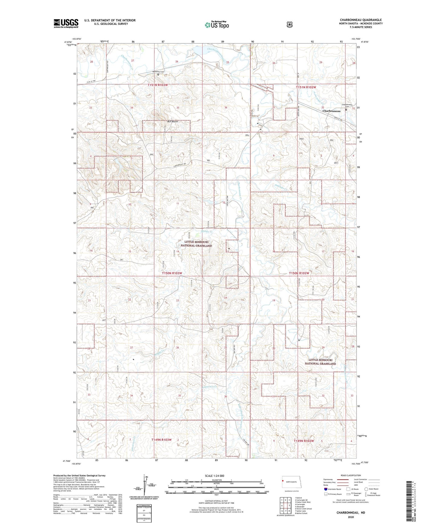
Charbonneau North Dakota US Topo Map
Couldn't load pickup availability
Also explore the Charbonneau Forest Service Topo of this same quad for updated USFS data
2024 topographic map quadrangle Charbonneau in the state of North Dakota. Scale: 1:24000. Based on the newly updated USGS 7.5' US Topo map series, this map is in the following counties: McKenzie. The map contains contour data, water features, and other items you are used to seeing on USGS maps, but also has updated roads and other features. This is the next generation of topographic maps. Printed on high-quality waterproof paper with UV fade-resistant inks.
Quads adjacent to this one:
West: Cartwright
Northwest: Buford
North: Cartwright NE
Northeast: Camp Creek West
East: Alexander
Southeast: Moline School
South: Sather Lake
Southwest: Horse Creek School
This map covers the same area as the classic USGS quad with code o47103g7.
Contains the following named places: Allred County, Antelope Creek, Bull Butte, Charbonneau, Charbonneau Cemetery, G Jacobsen Ranch, J Kykendall Ranch, Jackson Dam, Jacobson Flowing Water Well, Johntown Creek, L Tjelde Ranch, Lonesome Creek, Middle Creek, N Rod Ranch, Nameless Cemetery, V Foreman Ranch, West Branch Charbonneau Creek