MyTopo
Aneta North Dakota US Topo Map
Couldn't load pickup availability
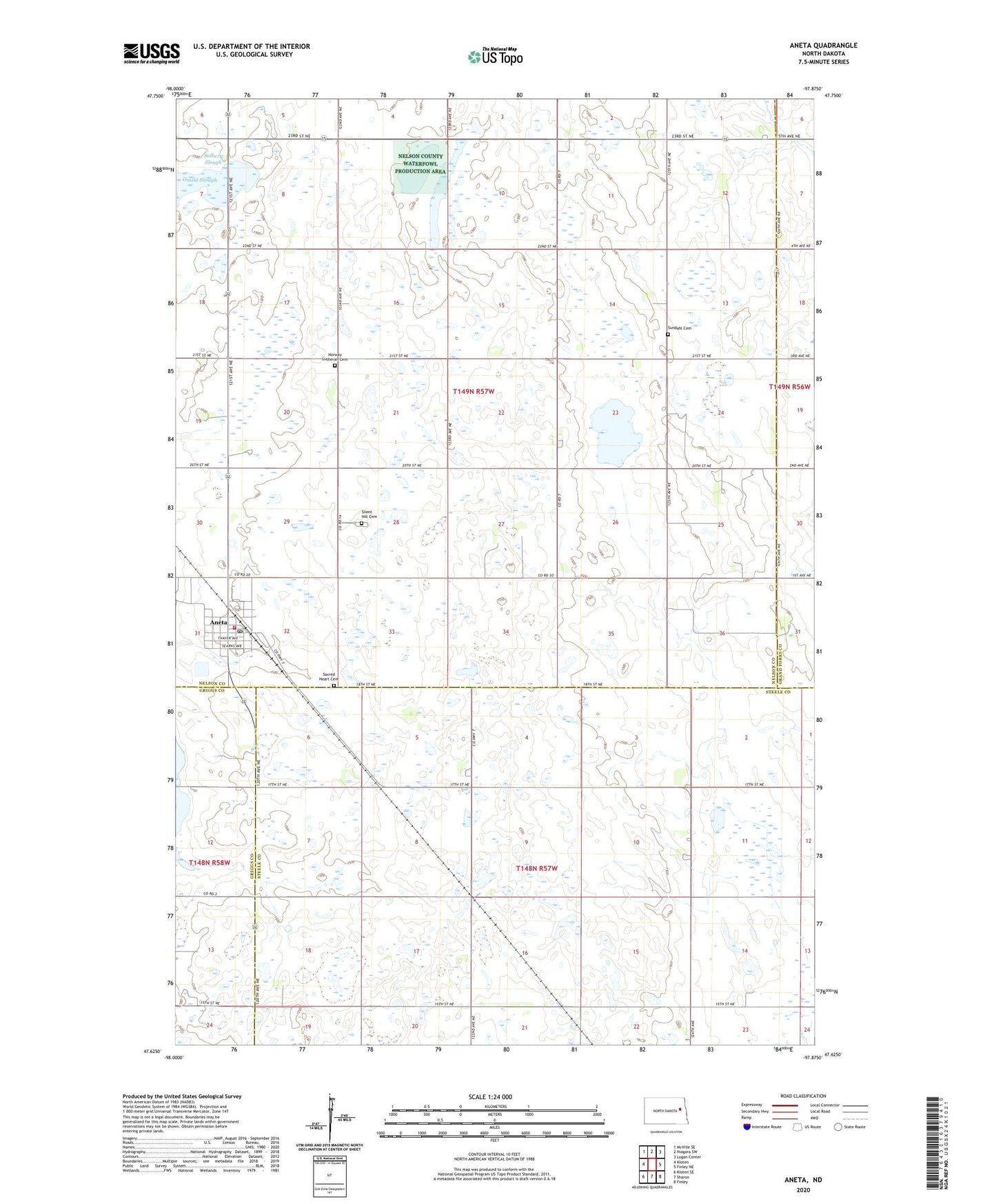
2024 topographic map quadrangle Aneta in the state of North Dakota. Scale: 1:24000. Based on the newly updated USGS 7.5' US Topo map series, this map is in the following counties: Nelson, Steele, Griggs, Grand Forks. The map contains contour data, water features, and other items you are used to seeing on USGS maps, but also has updated roads and other features. This is the next generation of topographic maps. Printed on high-quality waterproof paper with UV fade-resistant inks.
Quads adjacent to this one:
West: Kloten
Northwest: McVille SE
North: Niagara SW
Northeast: Logan Center
East: Finley NE
Southeast: Finley
South: Sharon
Southwest: Kloten SE
This map covers the same area as the classic USGS quad with code o47097f8.
Contains the following named places: Aneta, Aneta Ambulance Service, Aneta City Fire Department, Aneta Parkview Health Center, Aneta Post Office, Aneta Public Library, City of Aneta, Goose Creek, Matson Slough, Norway Church, Norway Lutheran Cemetery, Ora Town Hall, Sacred Heart Cemetery, Silent Hill Cemetery, Solberg Slough, Sundahl Cemetery, Township of Hoiland, Township of Ora, Township of Sharon