MyTopo
Finley North Dakota US Topo Map
Couldn't load pickup availability
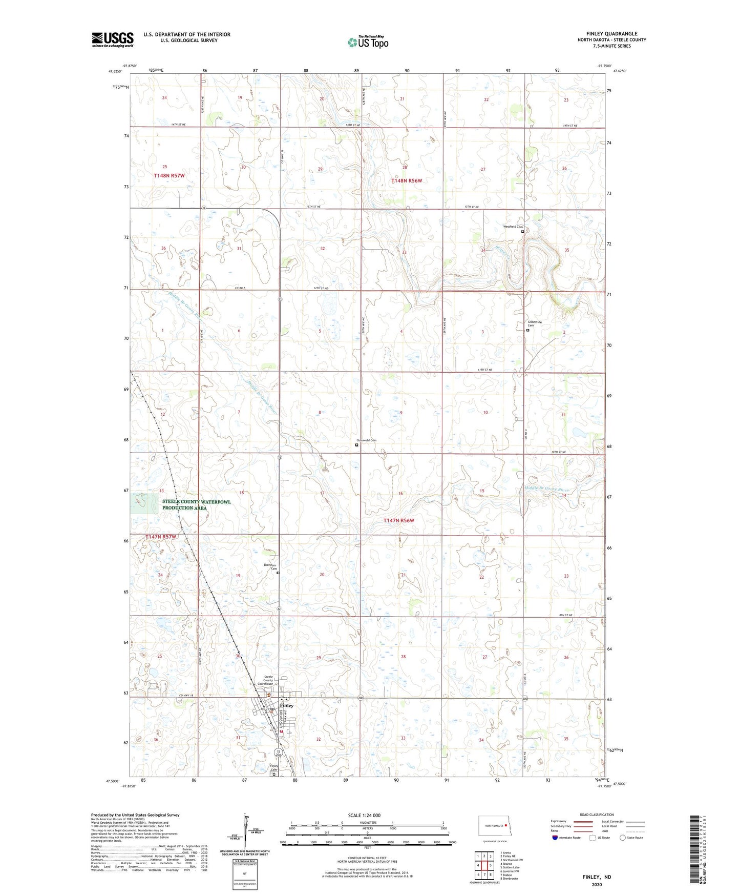
2024 topographic map quadrangle Finley in the state of North Dakota. Scale: 1:24000. Based on the newly updated USGS 7.5' US Topo map series, this map is in the following counties: Steele. The map contains contour data, water features, and other items you are used to seeing on USGS maps, but also has updated roads and other features. This is the next generation of topographic maps. Printed on high-quality waterproof paper with UV fade-resistant inks.
Quads adjacent to this one:
West: Sharon
Northwest: Aneta
North: Finley NE
Northeast: Northwood NW
East: Golden Lake
Southeast: Sherbrooke
South: Blabon
Southwest: Luverne NW
This map covers the same area as the classic USGS quad with code o47097e7.
Contains the following named places: City of Finley, Ebenezer Cemetery, Finley, Finley Air Force Station, Finley Airport, Finley Ambulance Service, Finley Cemetery, Finley City Hall, Finley Fire Protection District 203, Finley Post Office, Finley-Sharon Public School, Gilbertson Cemetery, Ostervold Cemetery, Ostervold Church, Steele County Courthouse, Steele County Sheriff's Office, Township of Finley, Westfield Cemetery, ZIP Code: 58277