MyTopo
Ardoch North Dakota US Topo Map
Couldn't load pickup availability
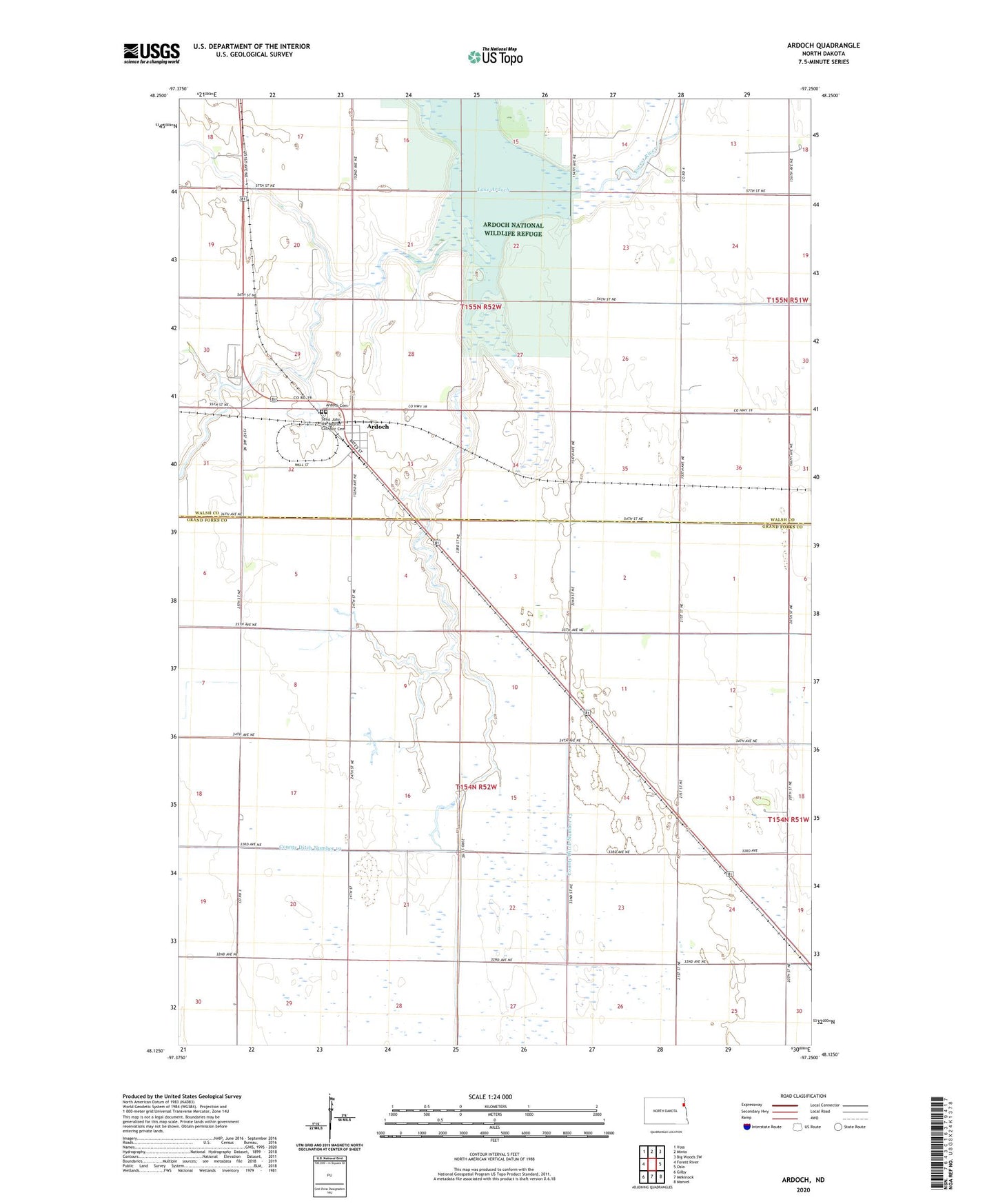
2024 topographic map quadrangle Ardoch in the state of North Dakota. Scale: 1:24000. Based on the newly updated USGS 7.5' US Topo map series, this map is in the following counties: Grand Forks, Walsh. The map contains contour data, water features, and other items you are used to seeing on USGS maps, but also has updated roads and other features. This is the next generation of topographic maps. Printed on high-quality waterproof paper with UV fade-resistant inks.
Quads adjacent to this one:
West: Forest River
Northwest: Voss
North: Minto
Northeast: Big Woods SW
Southeast: Manvel
South: Mekinock
Southwest: Gilby
This map covers the same area as the classic USGS quad with code o48097b3.
Contains the following named places: Ardoch, Ardoch Cemetery, Ardoch National Wildlife Refuge, City of Ardoch, County Ditch Number 19, Lake Ardoch, Lake Ardoch Dam, Prairie Chicken State Game Management Area, Saint John the Baptist Catholic Cemetery, Township of Ardoch, Township of Levant, ZIP Code: 58261