MyTopo
Belcourt North Dakota US Topo Map
Couldn't load pickup availability
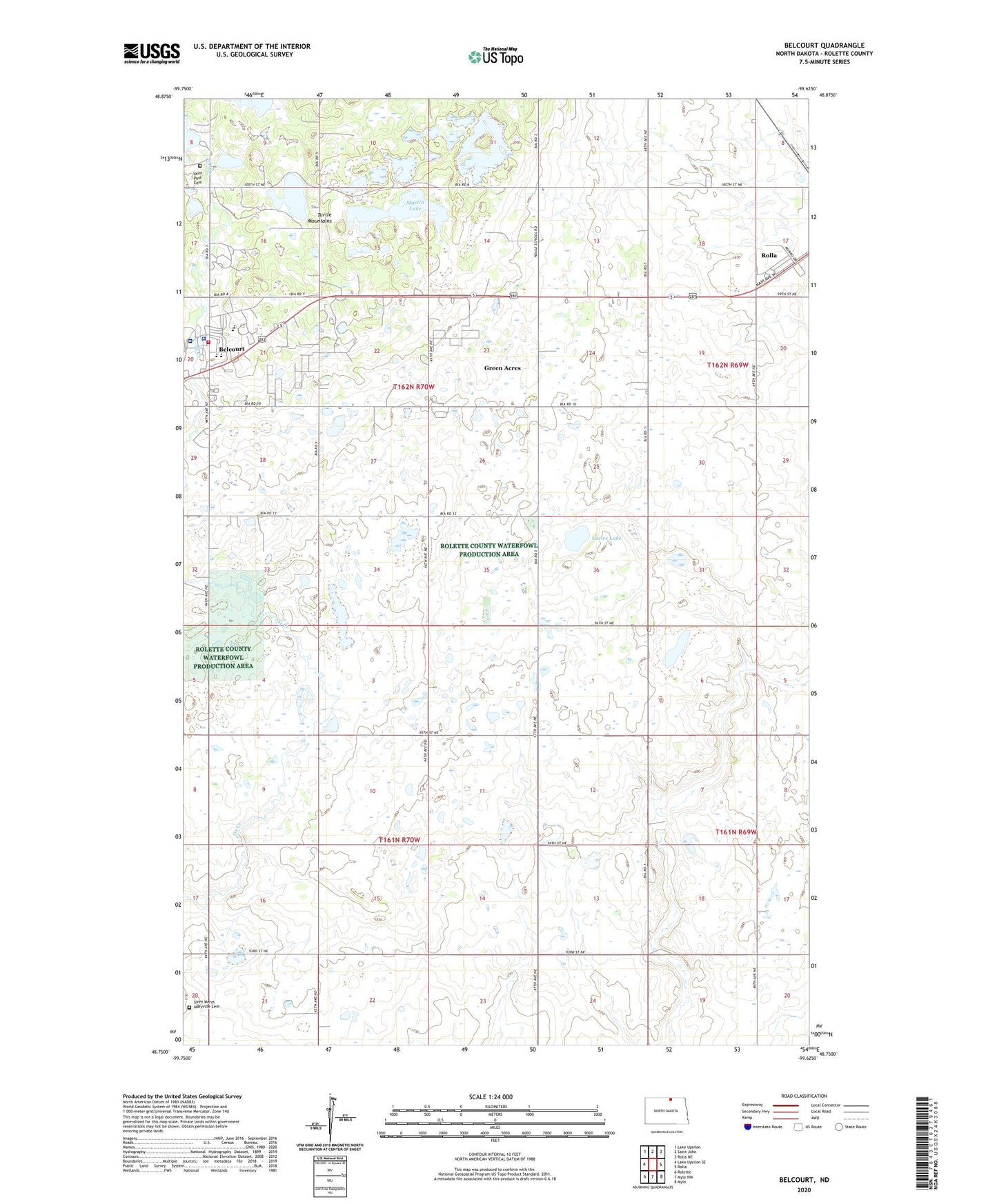
2024 topographic map quadrangle Belcourt in the state of North Dakota. Scale: 1:24000. Based on the newly updated USGS 7.5' US Topo map series, this map is in the following counties: Rolette. The map contains contour data, water features, and other items you are used to seeing on USGS maps, but also has updated roads and other features. This is the next generation of topographic maps. Printed on high-quality waterproof paper with UV fade-resistant inks.
Quads adjacent to this one:
West: Lake Upsilon SE
Northwest: Lake Upsilon
North: Saint John
Northeast: Rolla NE
East: Rolla
Southeast: Mylo
South: Mylo NW
Southwest: Rolette
This map covers the same area as the classic USGS quad with code o48099g6.
Contains the following named places: An - Qui - Ni - Gay Indian Burial Ground, Belcourt, Belcourt Ambulance Service, Belcourt Census Designated Place, Belcourt Rural Fire Department, Green Acres Census Designated Place, Lucies Lake, Martin Lake, Quentin Burdick Memorial Hospital, Saint Marys Maryville Cemetery, Saint Paul Cemetery, Township of Maryville, Turtle Mountain Community Elementary School, Turtle Mountain Community High School, Turtle Mountain Community Middle School