MyTopo
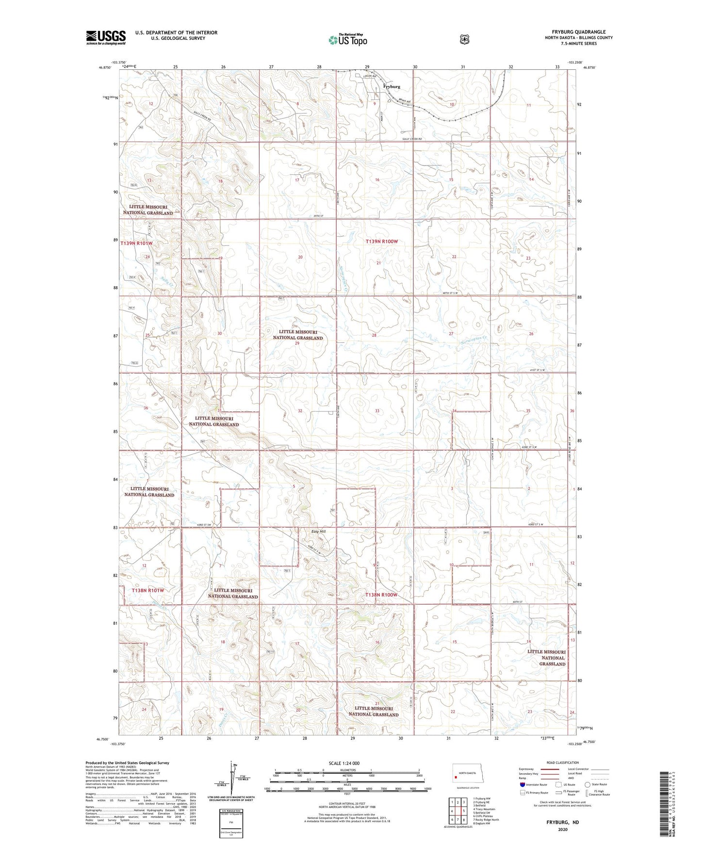
Fryburg North Dakota US Topo Map
Couldn't load pickup availability
Also explore the Fryburg Forest Service Topo of this same quad for updated USFS data
2024 topographic map quadrangle Fryburg in the state of North Dakota. Scale: 1:24000. Based on the newly updated USGS 7.5' US Topo map series, this map is in the following counties: Billings. The map contains contour data, water features, and other items you are used to seeing on USGS maps, but also has updated roads and other features. This is the next generation of topographic maps. Printed on high-quality waterproof paper with UV fade-resistant inks.
Quads adjacent to this one:
West: Tracy Mountain
Northwest: Fryburg NW
North: Fryburg NE
Northeast: Belfield
East: Belfield SW
Southeast: Daglum NW
South: Rocky Ridge North
Southwest: Cliffs Plateau
This map covers the same area as the classic USGS quad with code o46103g3.
Contains the following named places: Adams Ranch, Brueni Ranch, Ceperley Ranch, Custers Campsite, Easy Hill, Fryburg, Fryburg Oil Field, Ingman Ranch, Kordonowy Ranch, Mattison Ranch, Miller Ranch, Shypkowski Ranch