MyTopo
Blacktail Coulee North Dakota US Topo Map
Couldn't load pickup availability
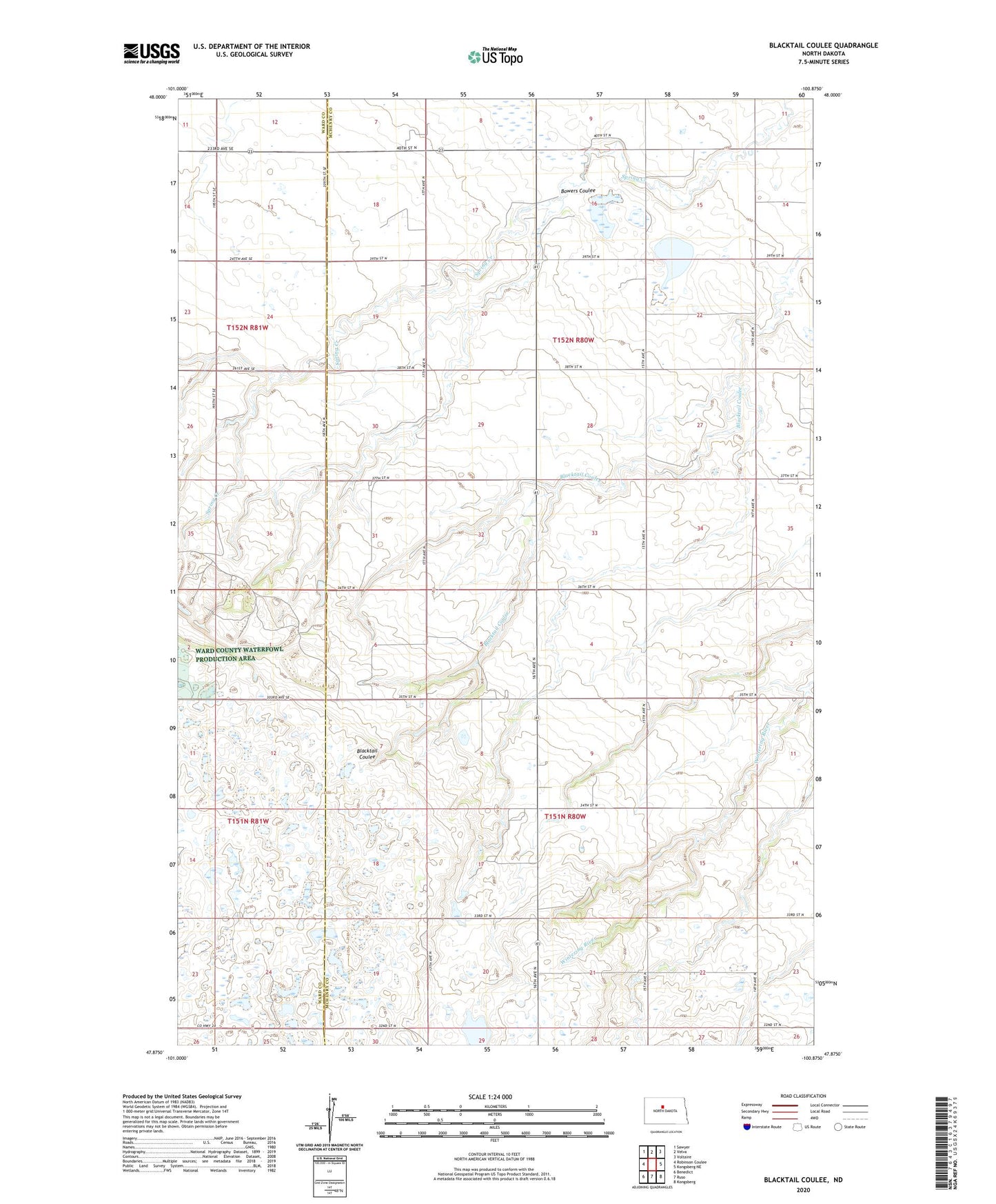
2024 topographic map quadrangle Blacktail Coulee in the state of North Dakota. Scale: 1:24000. Based on the newly updated USGS 7.5' US Topo map series, this map is in the following counties: McHenry, Ward. The map contains contour data, water features, and other items you are used to seeing on USGS maps, but also has updated roads and other features. This is the next generation of topographic maps. Printed on high-quality waterproof paper with UV fade-resistant inks.
Quads adjacent to this one:
West: Robinson Coulee
Northwest: Sawyer
North: Velva
Northeast: Voltaire
East: Kongsberg NE
Southeast: Kongsberg
South: Ruso
Southwest: Benedict
This map covers the same area as the classic USGS quad with code o47100h8.
Contains the following named places: Bowers Coulee, Bowers School, Langridge School, School Number 2, Township of Bjornson, Township of Brown, Velva Sportsman Dam, Ward School