MyTopo
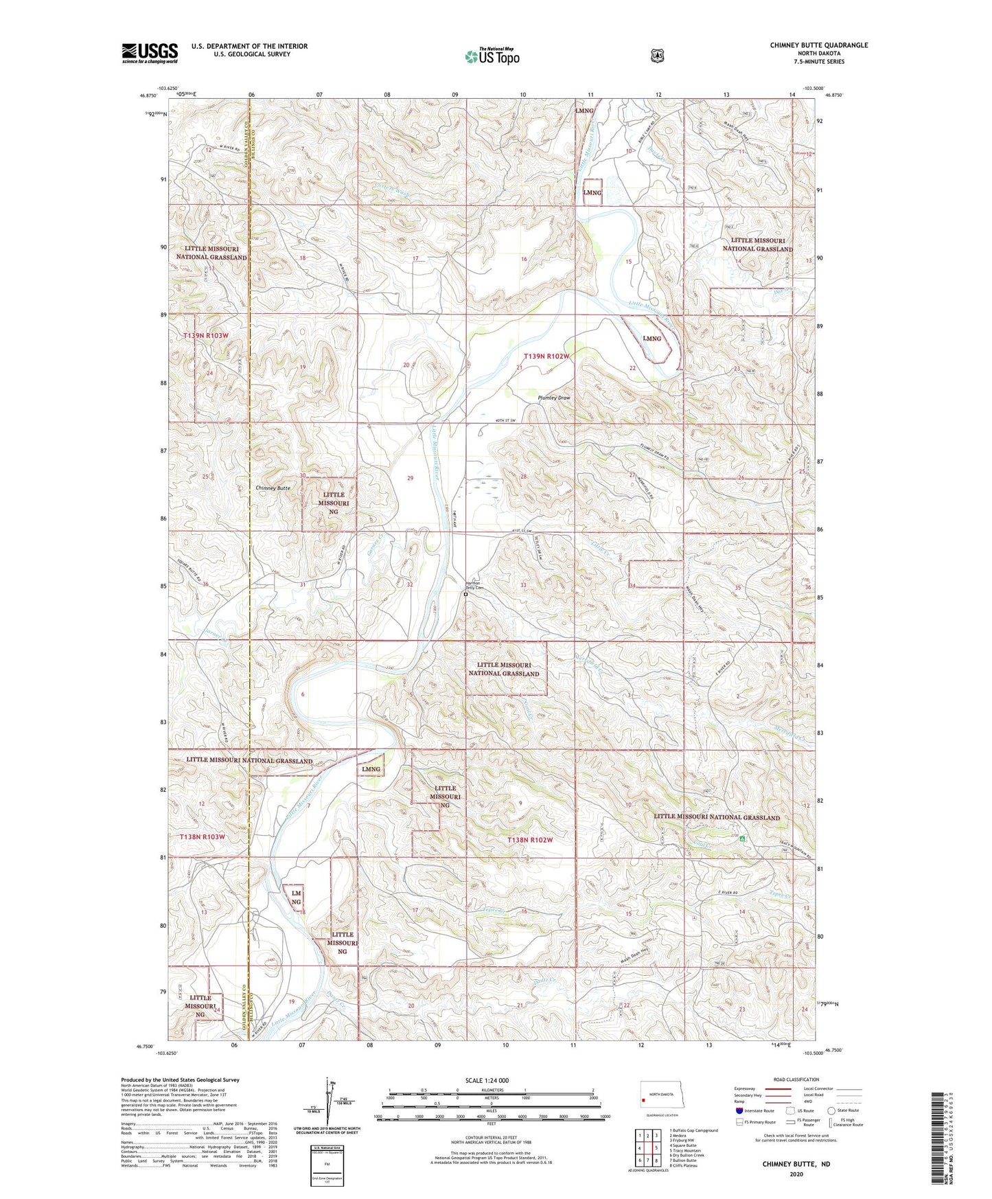
Chimney Butte North Dakota US Topo Map
Couldn't load pickup availability
Also explore the Chimney Butte Forest Service Topo of this same quad for updated USFS data
2024 topographic map quadrangle Chimney Butte in the state of North Dakota. Scale: 1:24000. Based on the newly updated USGS 7.5' US Topo map series, this map is in the following counties: Billings, Golden Valley. The map contains contour data, water features, and other items you are used to seeing on USGS maps, but also has updated roads and other features. This is the next generation of topographic maps. Printed on high-quality waterproof paper with UV fade-resistant inks.
Quads adjacent to this one:
West: Square Butte
Northwest: Buffalo Gap Campground
North: Medora
Northeast: Fryburg NW
East: Tracy Mountain
Southeast: Cliffs Plateau
South: Bullion Butte
Southwest: Dry Bullion Creek
This map covers the same area as the classic USGS quad with code o46103g5.
Contains the following named places: Bully Pulpit Golf Course, Burtkhart Ranch, Chimney Butte, Coal Creek, Custer Campground, Custer Trail Ranch, Custers Wash, Dantz Creek, Davis Creek, Garner Creek, Harmon - Tetly Cemetery, Little Creek, Madzo Ranch, Maltese Cross Ranch, McCutchen Ranch, Medora Oil Field, Merrifield Creek, Pellissier Ranch, Plumley Draw, S Connell Ranch, Tepee Creek, Transportation Museum, Vanvig Ranch