MyTopo
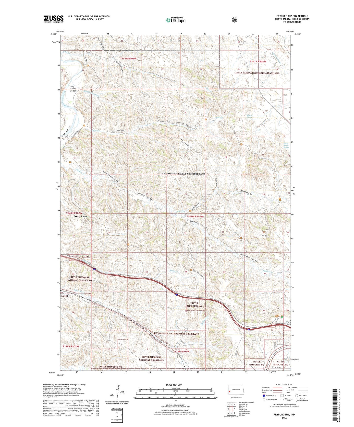
Fryburg NW North Dakota US Topo Map
Couldn't load pickup availability
Also explore the Fryburg NW Forest Service Topo of this same quad for updated USFS data
2024 topographic map quadrangle Fryburg NW in the state of North Dakota. Scale: 1:24000. Based on the newly updated USGS 7.5' US Topo map series, this map is in the following counties: Billings. The map contains contour data, water features, and other items you are used to seeing on USGS maps, but also has updated roads and other features. This is the next generation of topographic maps. Printed on high-quality waterproof paper with UV fade-resistant inks.
Quads adjacent to this one:
West: Medora
Northwest: Wannagan Creek East
North: Gorham SW
Northeast: Gorham SE
East: Fryburg NE
Southeast: Fryburg
South: Tracy Mountain
Southwest: Chimney Butte
This map covers the same area as the classic USGS quad with code o46103h4.
Contains the following named places: Beef Corral Bottom, Beef Corral Wash, Boicourt Spring, Buck Hill, Halliday Flowing Well, Halliday Well Recreation Site, Jones Creek, Jules Creek, Mike Auney Flowing Well, Paddock Creek, Painted Canyon Overlook, Painted Canyon Rest Area, Peaceful Valley, Scoria Point, Sheep Butte Spring, Theodore Roosevelt National Park