MyTopo
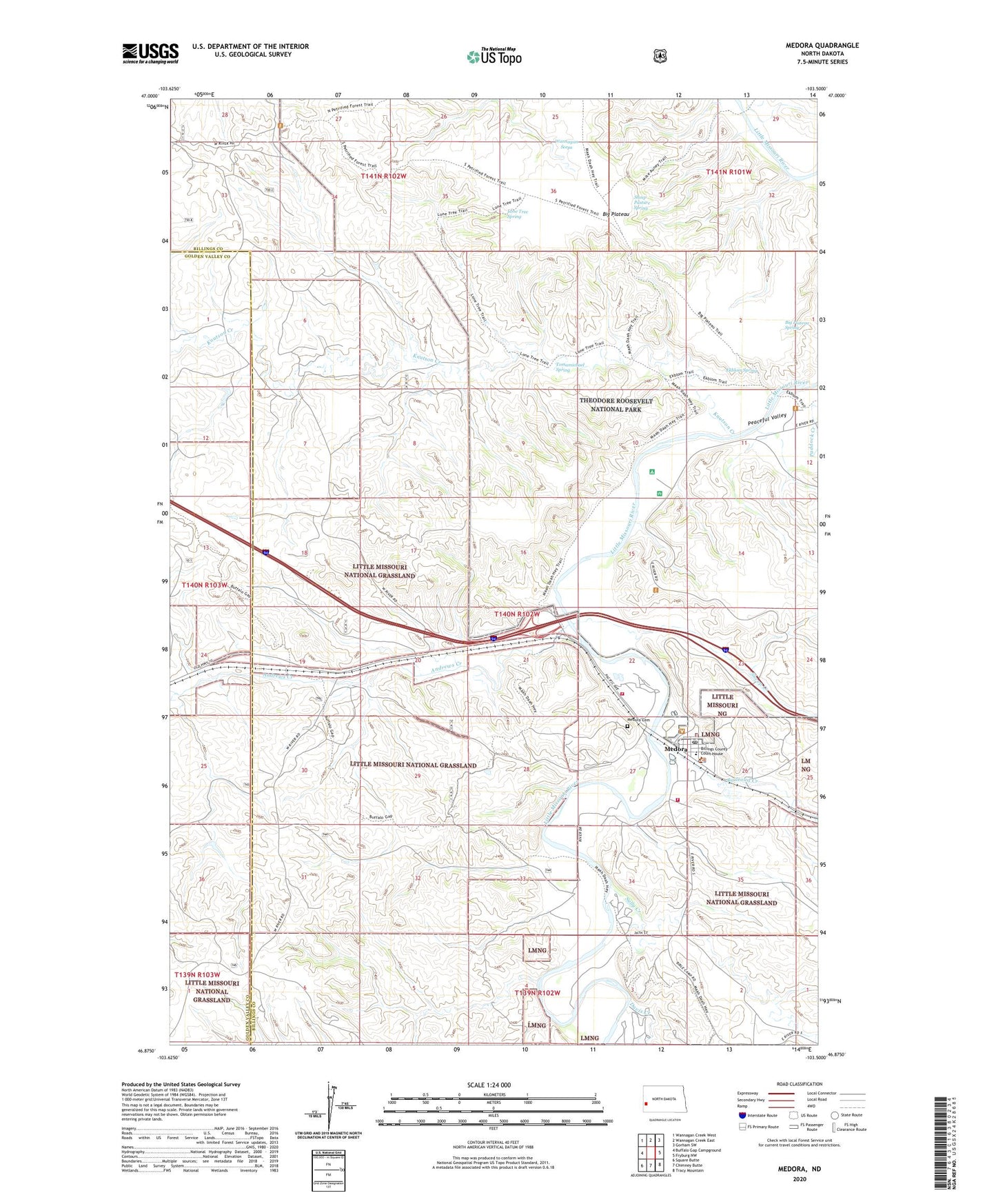
Medora North Dakota US Topo Map
Couldn't load pickup availability
Also explore the Medora Forest Service Topo of this same quad for updated USFS data
2024 topographic map quadrangle Medora in the state of North Dakota. Scale: 1:24000. Based on the newly updated USGS 7.5' US Topo map series, this map is in the following counties: Billings, Golden Valley. The map contains contour data, water features, and other items you are used to seeing on USGS maps, but also has updated roads and other features. This is the next generation of topographic maps. Printed on high-quality waterproof paper with UV fade-resistant inks.
Quads adjacent to this one:
West: Buffalo Gap Campground
Northwest: Wannagan Creek West
North: Wannagan Creek East
Northeast: Gorham SW
East: Fryburg NW
Southeast: Tracy Mountain
South: Chimney Butte
Southwest: Square Butte
This map covers the same area as the classic USGS quad with code o46103h5.
Contains the following named places: Andrews Creek, Big Plateau, Big Plateau Spring, Billings County Ambulance Service, Billings County Courthouse, Billings County Courthouse Museum, Billings County Sheriff's Office, Buddy Ranch Airport, Burning Hills Amphitheatre, Chateau de Mores, Chautea de Mores Visitor Center, City of Medora, Cottonwood Campground, DeMores Elementary School, Ekblom Spring, Harold Schafer Heritage Center, Hellickson Ranch, Knutson Creek, Lone Tree Spring, Medora, Medora Cemetery, Medora City Hall, Medora Fire Department, Medora Police Department, Medora Post Office, Medora Ranger Station, North Dakota Cowboy Hall of Fame, Peaceful Valley Ranch, Peaceful Valley Recreation Site, Railroad Creek, Rough Rider Campground, Sheep Creek, Sheep Pasture Spring, Spurgeon and Myers Ranch, Sully Creek, Sully Creek State Primitive Park, Tomamichael Spring, Wannagan Seeps, ZIP Code: 58645