MyTopo
Columbus North Dakota US Topo Map
Couldn't load pickup availability
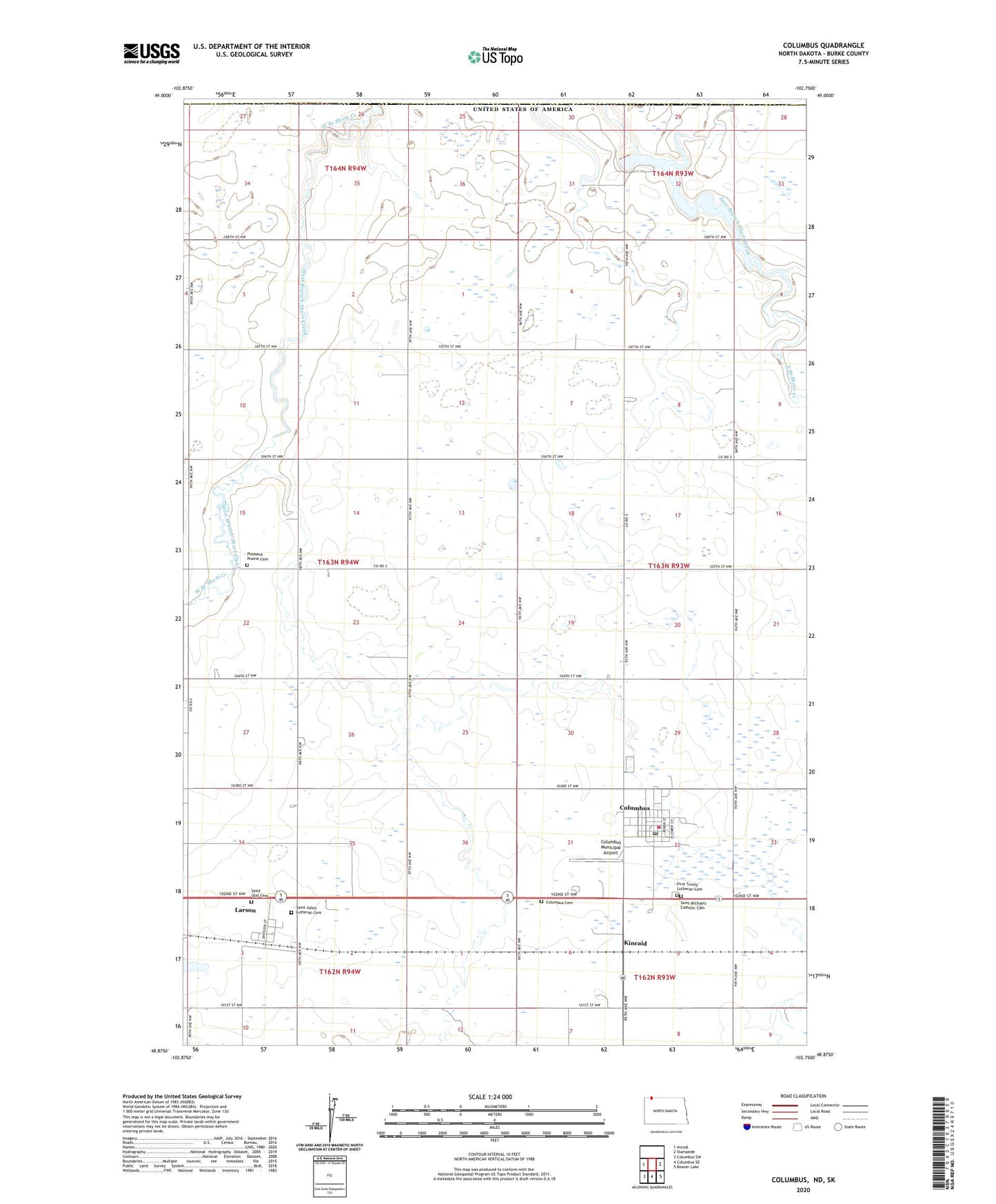
2024 topographic map quadrangle Columbus in the state of North Dakota. Scale: 1:24000. Based on the newly updated USGS 7.5' US Topo map series, this map is in the following counties: Burke. The map contains contour data, water features, and other items you are used to seeing on USGS maps, but also has updated roads and other features. This is the next generation of topographic maps. Printed on high-quality waterproof paper with UV fade-resistant inks.
Quads adjacent to this one:
West: Atcoal
East: Stampede
Southeast: Beaver Lake
South: Columbus SE
Southwest: Columbus SW
This map covers the same area as the classic USGS quad with code o48102h7.
Contains the following named places: Brookside School, City of Columbus, City of Larson, Columbus, Columbus Cemetery, Columbus Fire Protection District, Columbus Municipal Airport, Columbus Post Office, First Trinity Lutheran Cemetery, Kincaid, Larson, Larson Census Designated Place, Pleasant Prairie Cemetery, Pleasant Prairie Church, Saint Johns Lutheran Cemetery, Saint Michaels Catholic Cemetery, Saint Olaf Cemetery, Short Creek Dam, Township of Forthun, West Branch Short Creek