MyTopo
Columbus SE North Dakota US Topo Map
Couldn't load pickup availability
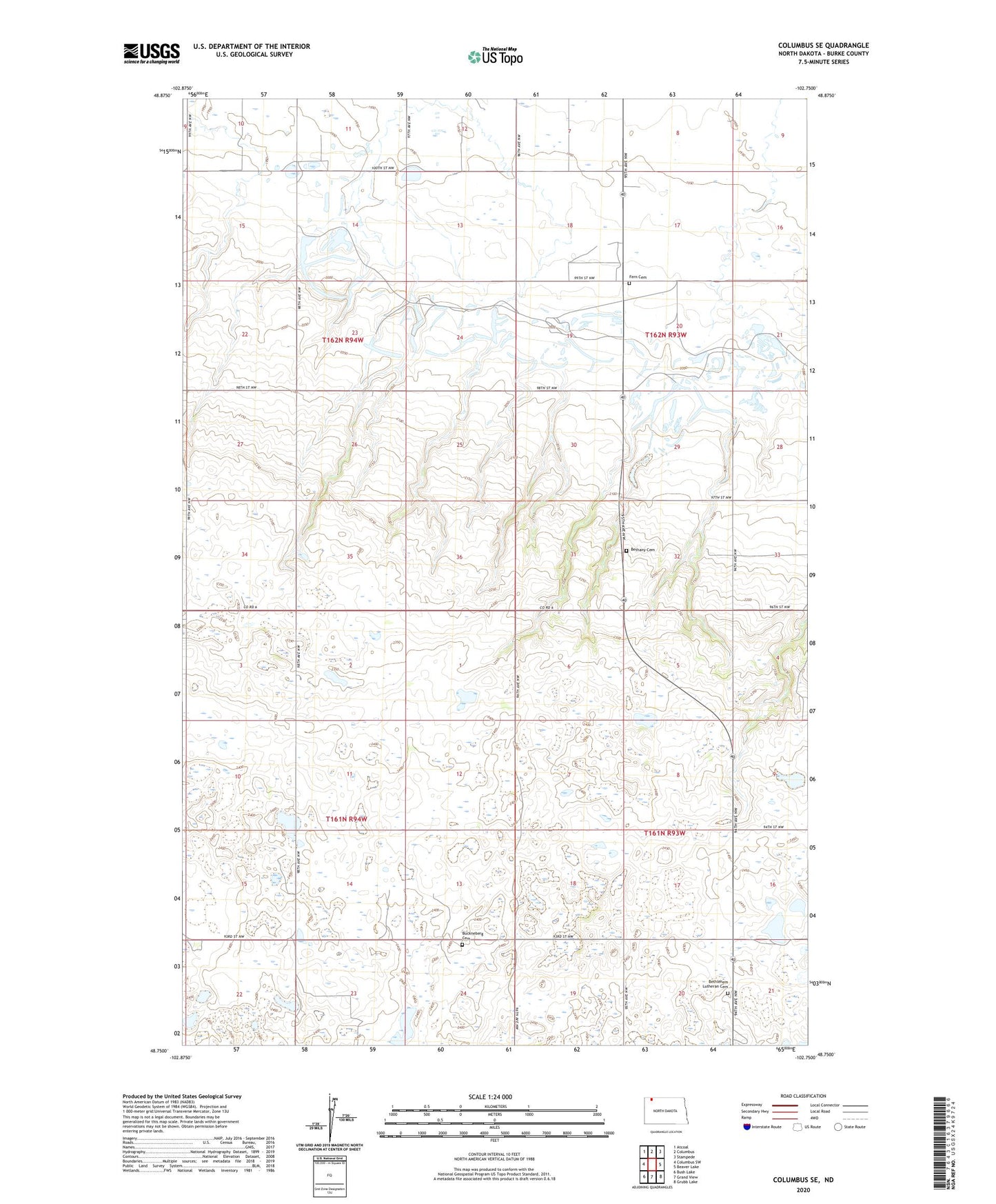
2024 topographic map quadrangle Columbus SE in the state of North Dakota. Scale: 1:24000. Based on the newly updated USGS 7.5' US Topo map series, this map is in the following counties: Burke. The map contains contour data, water features, and other items you are used to seeing on USGS maps, but also has updated roads and other features. This is the next generation of topographic maps. Printed on high-quality waterproof paper with UV fade-resistant inks.
Quads adjacent to this one:
West: Columbus SW
Northwest: Atcoal
North: Columbus
Northeast: Stampede
East: Beaver Lake
Southeast: Grubb Lake
South: Grand View
Southwest: Bush Lake
This map covers the same area as the classic USGS quad with code o48102g7.
Contains the following named places: Bethany Cemetery, Bethany Church, Bethlehem Church, Bethlehem Lutheran Cemetery, Buckneberg Cemetery, Coal Valley School Number 3, Fern Cemetery, Grandview School Number 1, School Number 1, School Number 4, Township of Harmonious, Township of Keller, Wildwood Park, ZIP Code: 58727