MyTopo
LaMoure North Dakota US Topo Map
Couldn't load pickup availability
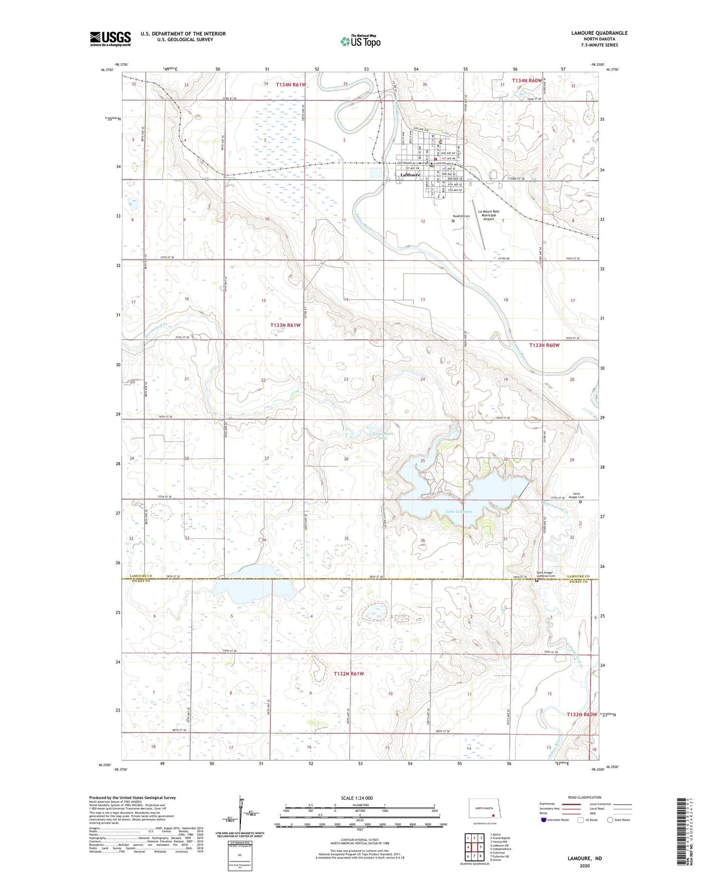
2024 topographic map quadrangle LaMoure in the state of North Dakota. Scale: 1:24000. Based on the newly updated USGS 7.5' US Topo map series, this map is in the following counties: LaMoure, Dickey. The map contains contour data, water features, and other items you are used to seeing on USGS maps, but also has updated roads and other features. This is the next generation of topographic maps. Printed on high-quality waterproof paper with UV fade-resistant inks.
Quads adjacent to this one:
West: LaMoure SW
Northwest: Berlin
North: Grand Rapids
Northeast: Verona NW
East: Independence
Southeast: Glover
South: Fullerton NE
Southwest: Fullerton
Contains the following named places: City of LaMoure, Community Volunteer Emergency Medical Services of LaMoure, Cottonwood Church, Cottonwood Creek, Cottonwood Creek Dam, Dean Town Hall, La Moure Police Department, La Moure Rott Municipal Airport, Lake LaMoure, LaMoure, LaMoure City Hall, LaMoure County Courthouse, LaMoure County Sheriff's Office, LaMoure Dam, LaMoure Fire Department, LaMoure Post Office, LaMoure Public School, LaMoure School and Public Library, Nevermore Lake, Rosehill Cemetery, Saint Ansgar Cemetery, Saint Ansgar Church, Saint Ansgar Lutheran Cemetery, Saint Rose Care Center, Township of Dean, Wright Town Hall, ZIP Code: 58458