MyTopo
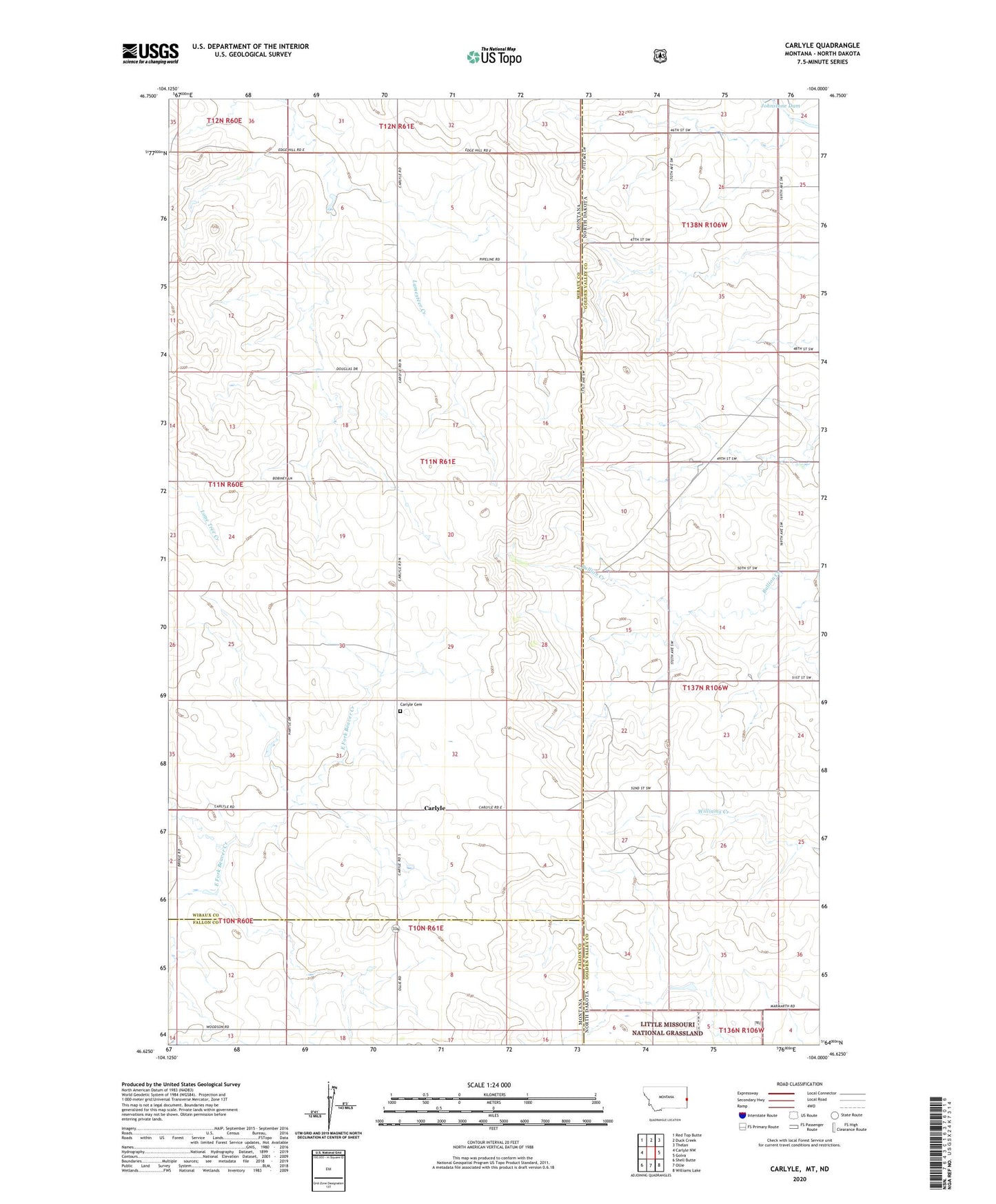
Carlyle Montana US Topo Map
Couldn't load pickup availability
Also explore the Carlyle Forest Service Topo of this same quad for updated USFS data
2024 topographic map quadrangle Carlyle in the state of Montana. Scale: 1:24000. Based on the newly updated USGS 7.5' US Topo map series, this map is in the following counties: Wibaux, Golden Valley, Fallon. The map contains contour data, water features, and other items you are used to seeing on USGS maps, but also has updated roads and other features. This is the next generation of topographic maps. Printed on high-quality waterproof paper with UV fade-resistant inks.
Quads adjacent to this one:
West: Carlyle NW
Northwest: Red Top Butte
North: Duck Creek
Northeast: Thelan
East: Golva
Southeast: Williams Lake
South: Ollie
Southwest: Shell Butte
Contains the following named places: 11N61E06DDAD01 Well, 11N61E18BABA01 Well, Bullion Creek, Carlyle, Carlyle Cemetery, Carlyle Lutheran Church, Carlyle Post Office, Carlyle School, Douglas School, Farmers Elevator, Occident Elevator