MyTopo
Linton North Dakota US Topo Map
Couldn't load pickup availability
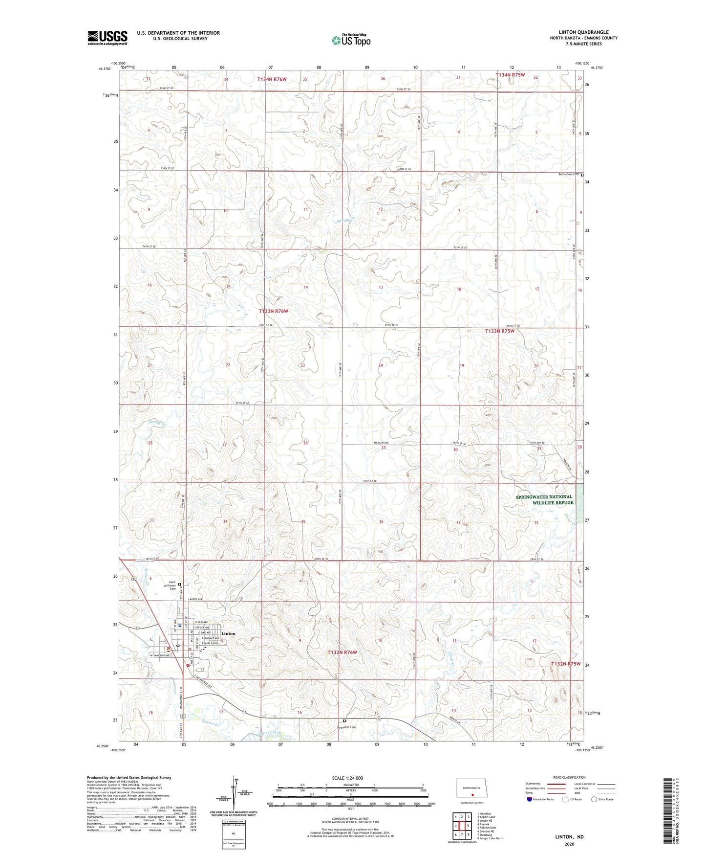
2024 topographic map quadrangle Linton in the state of North Dakota. Scale: 1:24000. Based on the newly updated USGS 7.5' US Topo map series, this map is in the following counties: Emmons. The map contains contour data, water features, and other items you are used to seeing on USGS maps, but also has updated roads and other features. This is the next generation of topographic maps. Printed on high-quality waterproof paper with UV fade-resistant inks.
Quads adjacent to this one:
West: Temvik
Northwest: Hazelton
North: Appert Lake
Northeast: Linton NE
East: Rohrich Dam
Southeast: Senger Lake North
South: Strasburg
Southwest: Grassna NE
This map covers the same area as the classic USGS quad with code o46100c2.
Contains the following named places: Bethlehem Cemetery, City of Linton, Clear Creek, Emmons County, Emmons County Courthouse, Emmons County Jail, Emmons County Museum, Emmons County Sheriff's Office, Harry L Petrie Public Library, Linton, Linton City Hall, Linton Country Club, Linton Fire Department, Linton Hospital, Linton Police Department, Linton Post Office, Linton Public School, Raynolds' Cemetery, Saint Anthonys Cemetery, Spring Creek, Spring Water Lake Dam, Township of McCulley