MyTopo
Minnewaukan East North Dakota US Topo Map
Couldn't load pickup availability
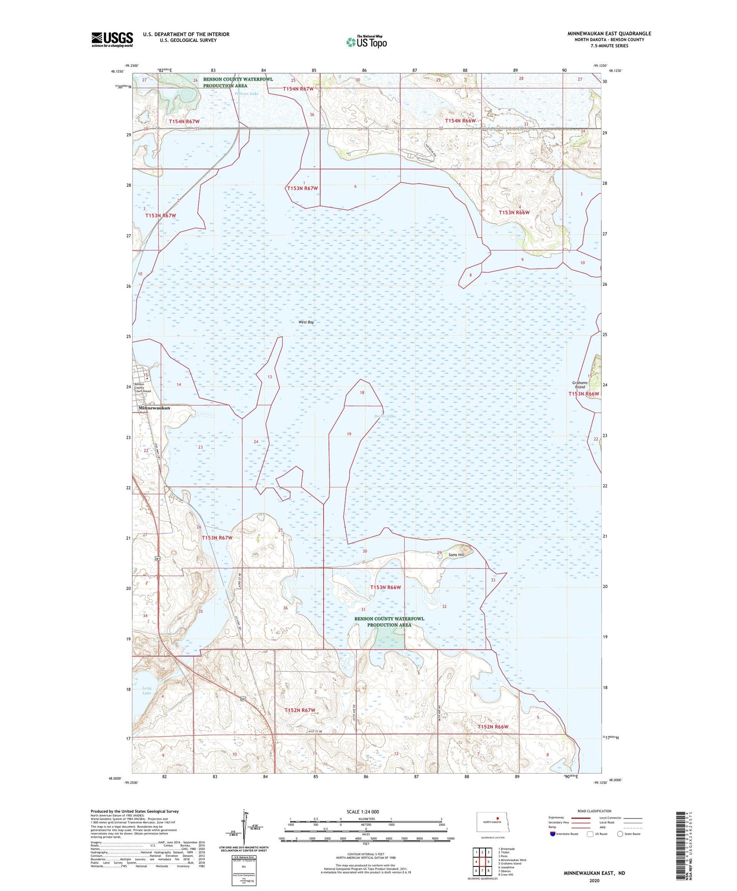
2024 topographic map quadrangle Minnewaukan East in the state of North Dakota. Scale: 1:24000. Based on the newly updated USGS 7.5' US Topo map series, this map is in the following counties: Benson. The map contains contour data, water features, and other items you are used to seeing on USGS maps, but also has updated roads and other features. This is the next generation of topographic maps. Printed on high-quality waterproof paper with UV fade-resistant inks.
Quads adjacent to this one:
West: Minnewaukan West
Northwest: Brinsmade
North: Tilden
Northeast: Penn
East: Grahams Island
Southeast: Crow Hill
South: Oberon
Southwest: Josephine
This map covers the same area as the classic USGS quad with code o48099a2.
Contains the following named places: Minnewaukan Museum, Minnewaukan Public School, Round Lake, Round Lake Outlet Control Dam, Sams Hill, School Number 1, Unorganized Territory of Lallie North, West Bay