MyTopo
Odland Dam North Dakota US Topo Map
Couldn't load pickup availability
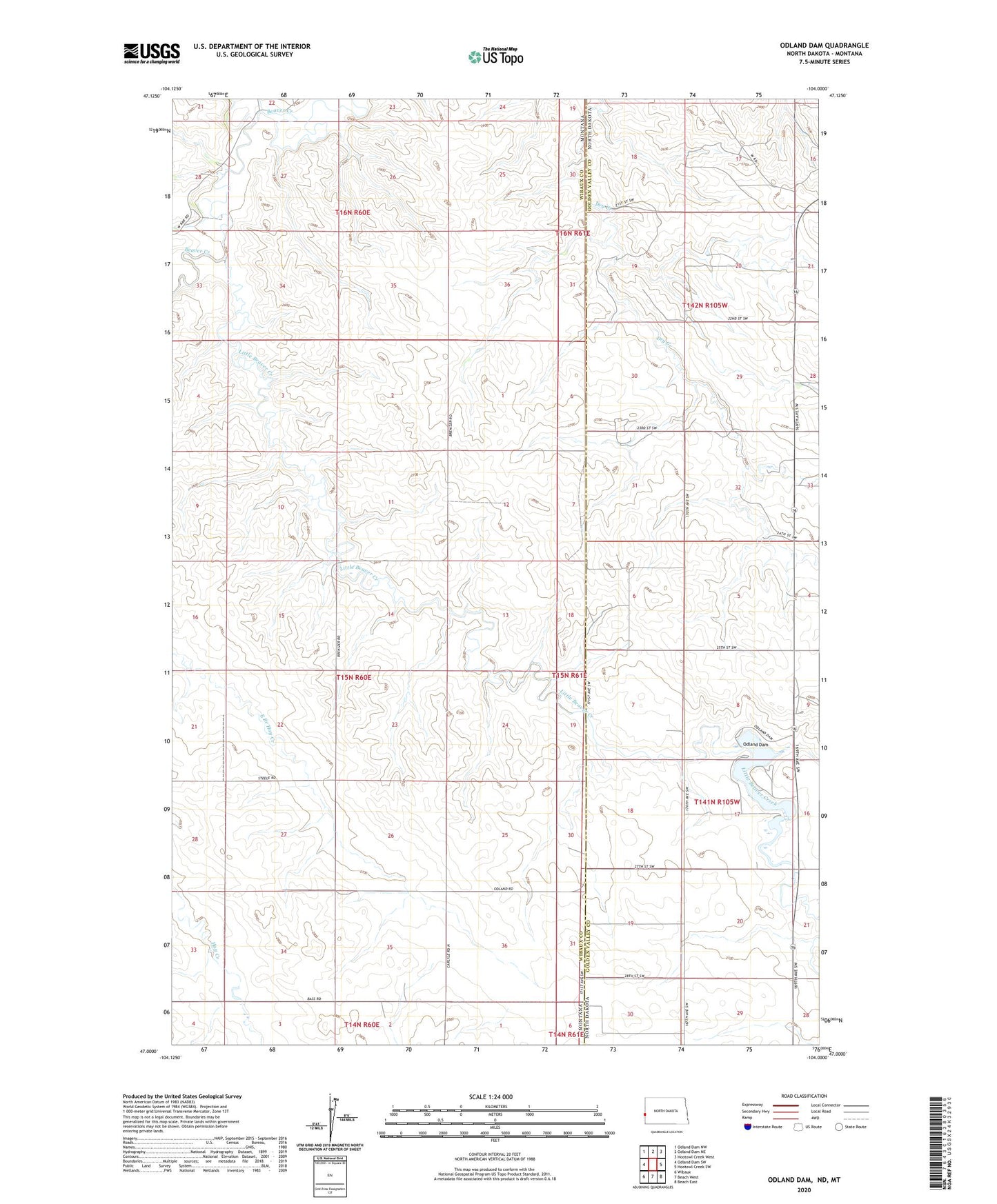
2024 topographic map quadrangle Odland Dam in the states of Montana, North Dakota. Scale: 1:24000. Based on the newly updated USGS 7.5' US Topo map series, this map is in the following counties: Golden Valley, Wibaux. The map contains contour data, water features, and other items you are used to seeing on USGS maps, but also has updated roads and other features. This is the next generation of topographic maps. Printed on high-quality waterproof paper with UV fade-resistant inks.
Quads adjacent to this one:
West: Odland Dam SW
Northwest: Odland Dam NW
North: Odland Dam NE
Northeast: Hootowl Creek West
East: Hootowl Creek SW
Southeast: Beach East
South: Beach West
Southwest: Wibaux
This map covers the same area as the classic USGS quad with code o47104a1.
Contains the following named places: 14N61E06CCA_01 Well, 14N61E06CCA_02 Well, 14N61E06CCA02_ Well, 15N60E10CCCC01 Well, 15N60E14AAAA01 Well, 15N60E14CCC01_ Well, 15N60E22CCCD01 Well, 15N60E26AAAB01 Well, 15N60E26BBBB01 Well, 15N60E26BCC_01 Well, 15N60E34CBB01_ Well, 15N60E34CBB02_ Well, 15N60E35DCC01_ Well, 15N60E35DCC02_ Well, 15N61E30AAA01_ Well, 15N61E30AAA02_ Well, 15N61E30CCC01_ Well, Brenizer Post Office, Brenizer School, Little Beaver Creek, Odland Dam, William Baird School