MyTopo
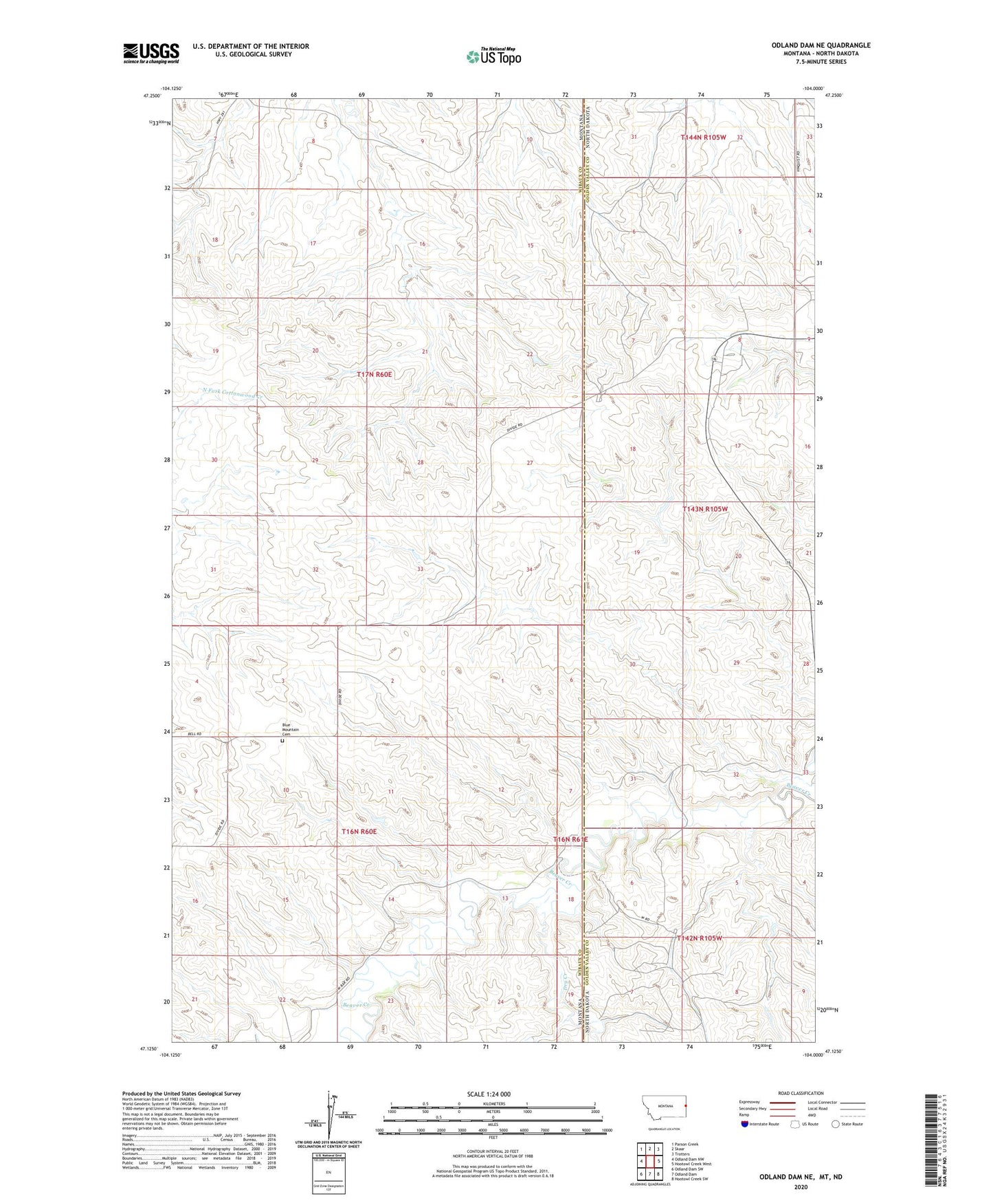
Odland Dam NE Montana US Topo Map
Couldn't load pickup availability
2024 topographic map quadrangle Odland Dam NE in the states of Montana, North Dakota. Scale: 1:24000. Based on the newly updated USGS 7.5' US Topo map series, this map is in the following counties: Wibaux, Golden Valley. The map contains contour data, water features, and other items you are used to seeing on USGS maps, but also has updated roads and other features. This is the next generation of topographic maps. Printed on high-quality waterproof paper with UV fade-resistant inks.
Quads adjacent to this one:
West: Odland Dam NW
Northwest: Parson Creek
North: Skaar
Northeast: Trotters
East: Hootowl Creek West
Southeast: Hootowl Creek SW
South: Odland Dam
Southwest: Odland Dam SW
Contains the following named places: 16N60E02BDDB01 Well, 16N60E02DBC_01 Well, 16N60E13ABAD01 Well, 17N60E05BBB_01 Well, 17N60E07DCCB01 Well, 17N60E17DCAB01 Well, Arvid School, Blue Mountain Cemetery, Daley School, Dry Creek, Hollar Dam, Lucky Creek School, W-Bar School