MyTopo
Odland Dam NW Montana US Topo Map
Couldn't load pickup availability
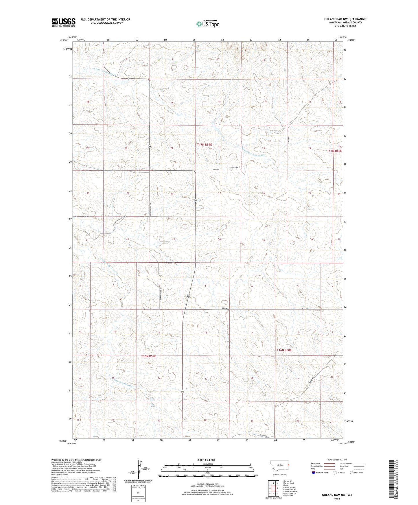
2024 topographic map quadrangle Odland Dam NW in the state of Montana. Scale: 1:24000. Based on the newly updated USGS 7.5' US Topo map series, this map is in the following counties: Wibaux. The map contains contour data, water features, and other items you are used to seeing on USGS maps, but also has updated roads and other features. This is the next generation of topographic maps. Printed on high-quality waterproof paper with UV fade-resistant inks.
Quads adjacent to this one:
West: Cluster Buttes
Northwest: Savage SE
North: Parson Creek
Northeast: Skaar
East: Odland Dam NE
Southeast: Odland Dam
South: Odland Dam SW
Southwest: Cluster Buttes SE
This map covers the same area as the classic USGS quad with code o47104b2.
Contains the following named places: 16N59E13CCB_01 Well, 17N59E14ACBD01 Well, 17N59E15AC__01 Well, 17N59E23BACD01 Well, 17N59E24BCC_01 Well, 17N59E26DBA_01 Well, 17N59E36BA__01 Well, Been, Been Cemetery, Been Post Office, Been School, Divide School, Wibaux Division, Williams School