MyTopo
Tappen North North Dakota US Topo Map
Couldn't load pickup availability
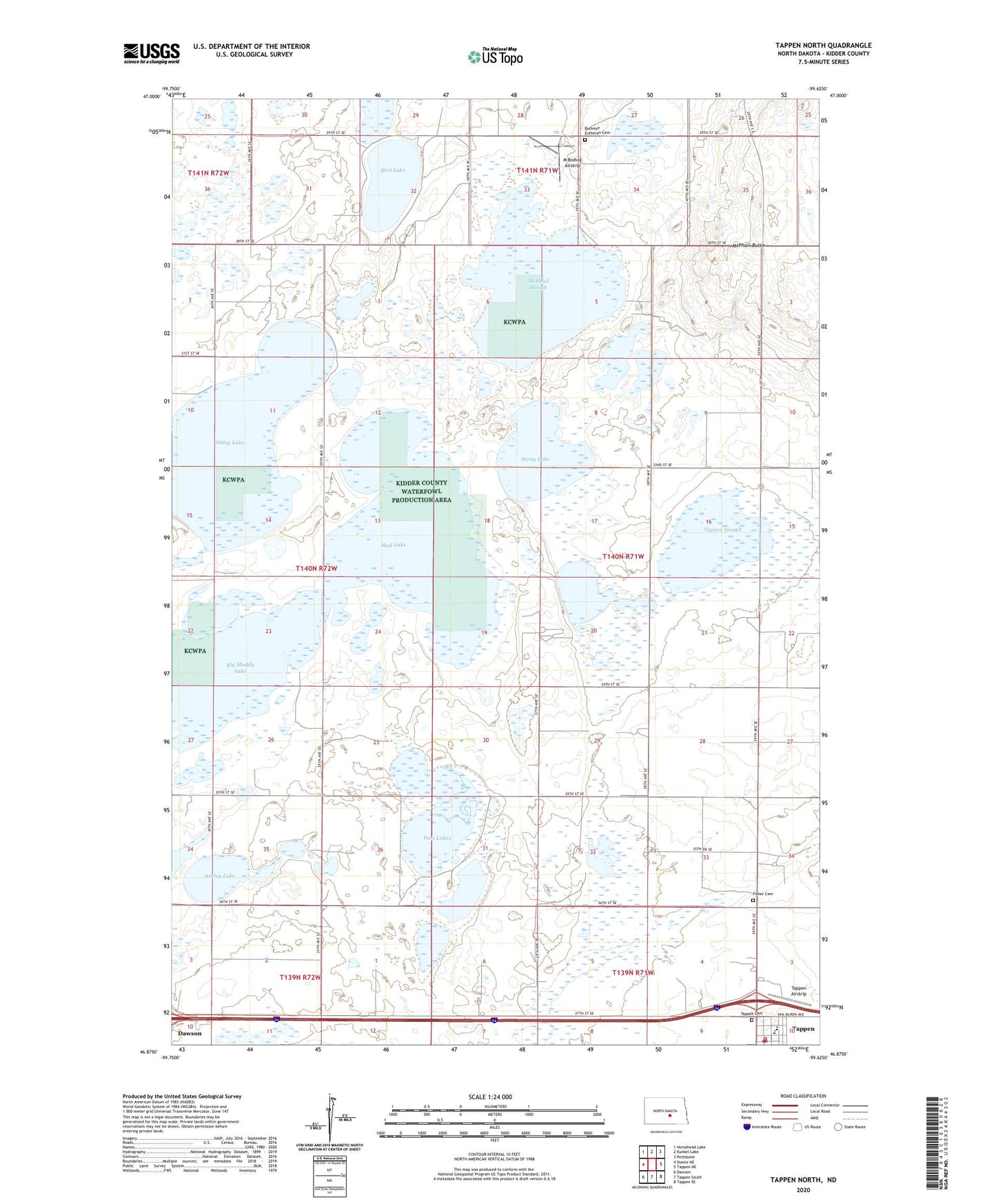
2024 topographic map quadrangle Tappen North in the state of North Dakota. Scale: 1:24000. Based on the newly updated USGS 7.5' US Topo map series, this map is in the following counties: Kidder. The map contains contour data, water features, and other items you are used to seeing on USGS maps, but also has updated roads and other features. This is the next generation of topographic maps. Printed on high-quality waterproof paper with UV fade-resistant inks.
Quads adjacent to this one:
West: Steele NE
Northwest: Horsehead Lake
North: Kunkel Lake
Northeast: Pettibone
East: Tappen NE
Southeast: Tappen SE
South: Tappen South
Southwest: Dawson
This map covers the same area as the classic USGS quad with code o46099h6.
Contains the following named places: Ashley Lake, Big Muddy Lake, Bird Lake, Buckeye Lutheran Cemetery, Fisher Cemetery, M Bodvig Airstrip, McPhail Butte, McPhail Butte Historic Monument, McPhail Slough, Mud Lake, Norwegian Church, Pass Lakes, School Number 2, School Number 3, Sibley Lake, Stony Lake, Tappen Airstrip, Tappen Cemetery, Tappen City Hall, Tappen Fire Department, Tappen Post Office, Tappen Public School, Tappen Slough, Township of Westford, White Field