MyTopo
Skaar North Dakota US Topo Map
Couldn't load pickup availability
Also explore the Skaar Forest Service Topo of this same quad for updated USFS data
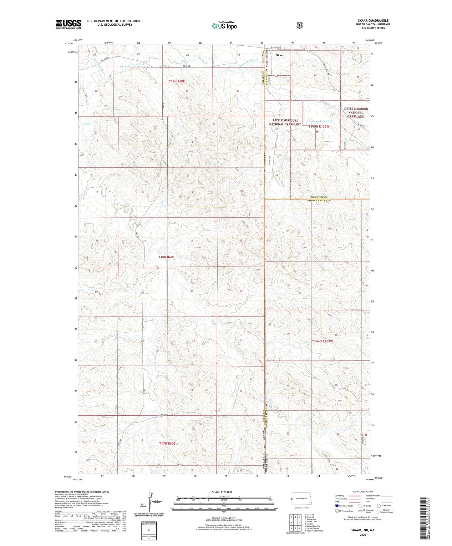
2024 topographic map quadrangle Skaar in the states of Montana, North Dakota. Scale: 1:24000. Based on the newly updated USGS 7.5' US Topo map series, this map is in the following counties: Golden Valley, Wibaux, McKenzie. The map contains contour data, water features, and other items you are used to seeing on USGS maps, but also has updated roads and other features. This is the next generation of topographic maps. Printed on high-quality waterproof paper with UV fade-resistant inks.
Quads adjacent to this one:
West: Parson Creek
Northwest: Skaar NW
North: Skaar NE
Northeast: Squaw Gap
East: Trotters
Southeast: Hootowl Creek West
South: Odland Dam NE
Southwest: Odland Dam NW
This map covers the same area as the classic USGS quad with code o47104c1.
Contains the following named places: 18N60E04AD__01 Well, 18N60E09AAD_01 Well, 18N60E15CBBB01 Well, 18N60E22DCCC01 Well, 18N60E29BDCC01 Well, 18N60E32DADB01 Well, 19N60E28CB__01 Well, 19N60E32AB__01 Well, 19N60E34BA__01 Well, C S Creek, C S Creek School, Deadman Creek, Metcalf Ranch, Metcalf Water Well, North Fork Smith Creek, Oliver School, Poison Spring Creek, Skaar, Smith Creek Grazing District Dam, South Fork Smith Creek, White Elk Dam