MyTopo
Verona North Dakota US Topo Map
Couldn't load pickup availability
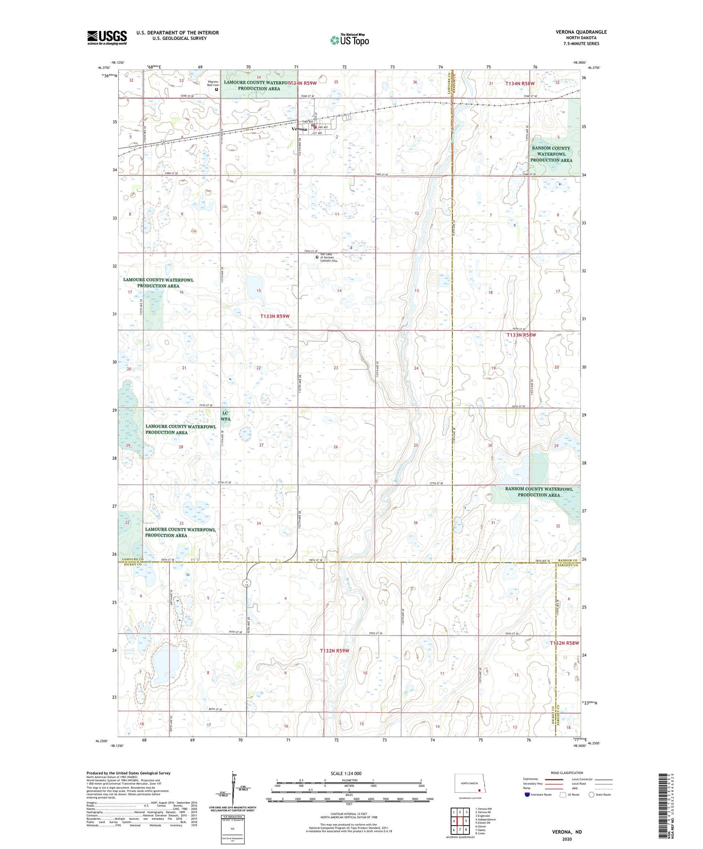
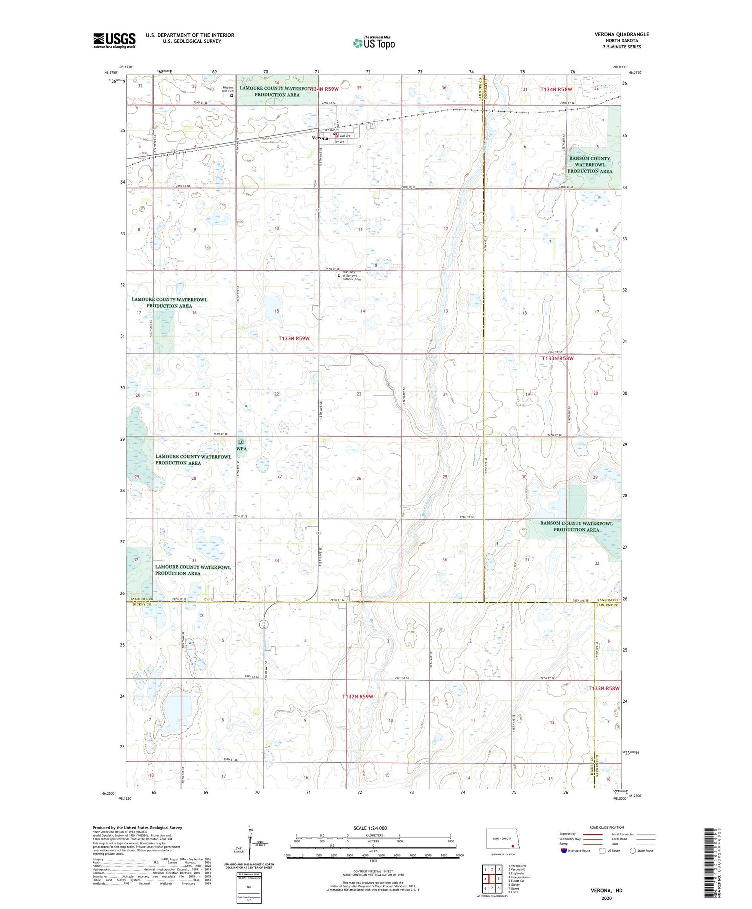
2020 topographic map quadrangle Verona in the state of North Dakota. Scale: 1:24000. Based on the newly updated USGS 7.5' US Topo map series, this map is in the following counties: LaMoure, Dickey, Ransom, Sargent. The map contains contour data, water features, and other items you are used to seeing on USGS maps, but also has updated roads and other features. This is the next generation of topographic maps. Printed on high-quality waterproof paper with UV fade-resistant inks.
Quads adjacent to this one:
West: Independence
Northwest: Verona NW
North: Verona NE
Northeast: Englevale
East: Elliott SW
Southeast: Crete
South: Oakes
Southwest: Glover
Contains the following named places: City of Verona, Our Lady of Sorrows Catholic Cemetery, Ovid Town Hall, Pilgrims Rest Cemetery, Township of Ovid, Verona, Verona Community Center, Verona Fire Department, Verona Post Office