MyTopo
Williston SE North Dakota US Topo Map
Couldn't load pickup availability
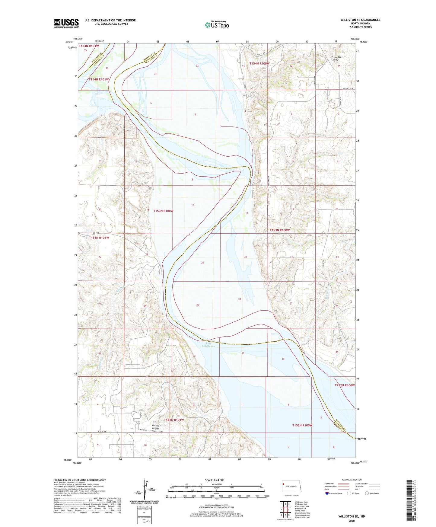
2024 topographic map quadrangle Williston SE in the state of North Dakota. Scale: 1:24000. Based on the newly updated USGS 7.5' US Topo map series, this map is in the following counties: McKenzie, Williams. The map contains contour data, water features, and other items you are used to seeing on USGS maps, but also has updated roads and other features. This is the next generation of topographic maps. Printed on high-quality waterproof paper with UV fade-resistant inks.
Quads adjacent to this one:
West: Williston SW
Northwest: Williston West
North: Williston East
Northeast: Stockyard Creek
East: Lake Jessie
Southeast: Watford City NW
South: Camp Creek East
Southwest: Camp Creek West
This map covers the same area as the classic USGS quad with code o48103a5.
Contains the following named places: Indian Creek, Indian Creek Bay Recreation Area, KEYZ-AM (Williston), Lindvig Airstrip, Old Muddy Bend, Plum Pudding Butte, Township of Stony Creek, Willow Creek