MyTopo
Williston East North Dakota US Topo Map
Couldn't load pickup availability
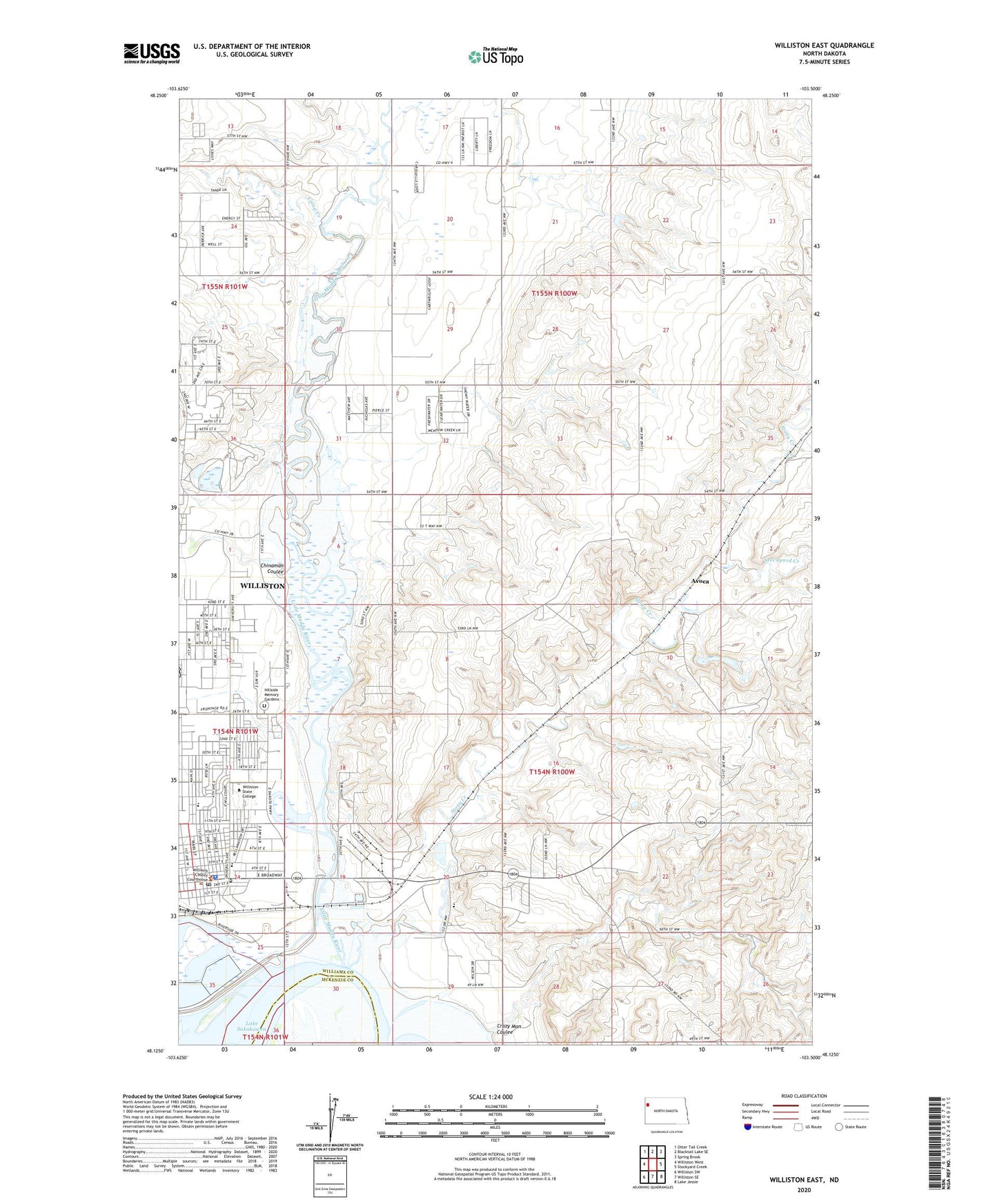
2024 topographic map quadrangle Williston East in the state of North Dakota. Scale: 1:24000. Based on the newly updated USGS 7.5' US Topo map series, this map is in the following counties: Williams, McKenzie. The map contains contour data, water features, and other items you are used to seeing on USGS maps, but also has updated roads and other features. This is the next generation of topographic maps. Printed on high-quality waterproof paper with UV fade-resistant inks.
Quads adjacent to this one:
West: Williston West
Northwest: Otter Tail Creek
North: Blacktail Lake SE
Northeast: Spring Brook
East: Stockyard Creek
Southeast: Lake Jessie
South: Williston SE
Southwest: Williston SW
This map covers the same area as the classic USGS quad with code o48103b5.
Contains the following named places: Abramson Hall, Art Wood Building, Avoca, Camp Creek, Chinaman Coulee, Crazy Man Coulee, Crighton Building, Dickson Hall, East Lawn Park, Frontier Hall, Frontier Museum, Harmon Park, Hillside Memory Gardens, Lake Park Drive-In, Little Muddy River, Manger Hall, McVay Elementary School, Nelson Hall, North Dakota Highway Patrol Northwest Region - Williston Office, Palmer School, Penman School, Powerhouse School, Rabon Field, Rickard Elementary School, Stevens Hall, Stockyard Creek, Stony Creek, Stony Creek Elementary School, Thomas Witt Leach Health Science and Sports Complex, Township of Pherrin, Twin Lakes Park, Unorganized Territory of Pherrin, Western Star Career and Technology Center, Williams County Courthouse, Williams County Sheriff's Office, Williston, Williston Basin Speedway, Williston City Hall, Williston Landfill, Williston Police Department, Williston Post Office, Williston State College, Williston State College Library, Wright Field Airport