MyTopo
Belfast Ohio US Topo Map
Couldn't load pickup availability
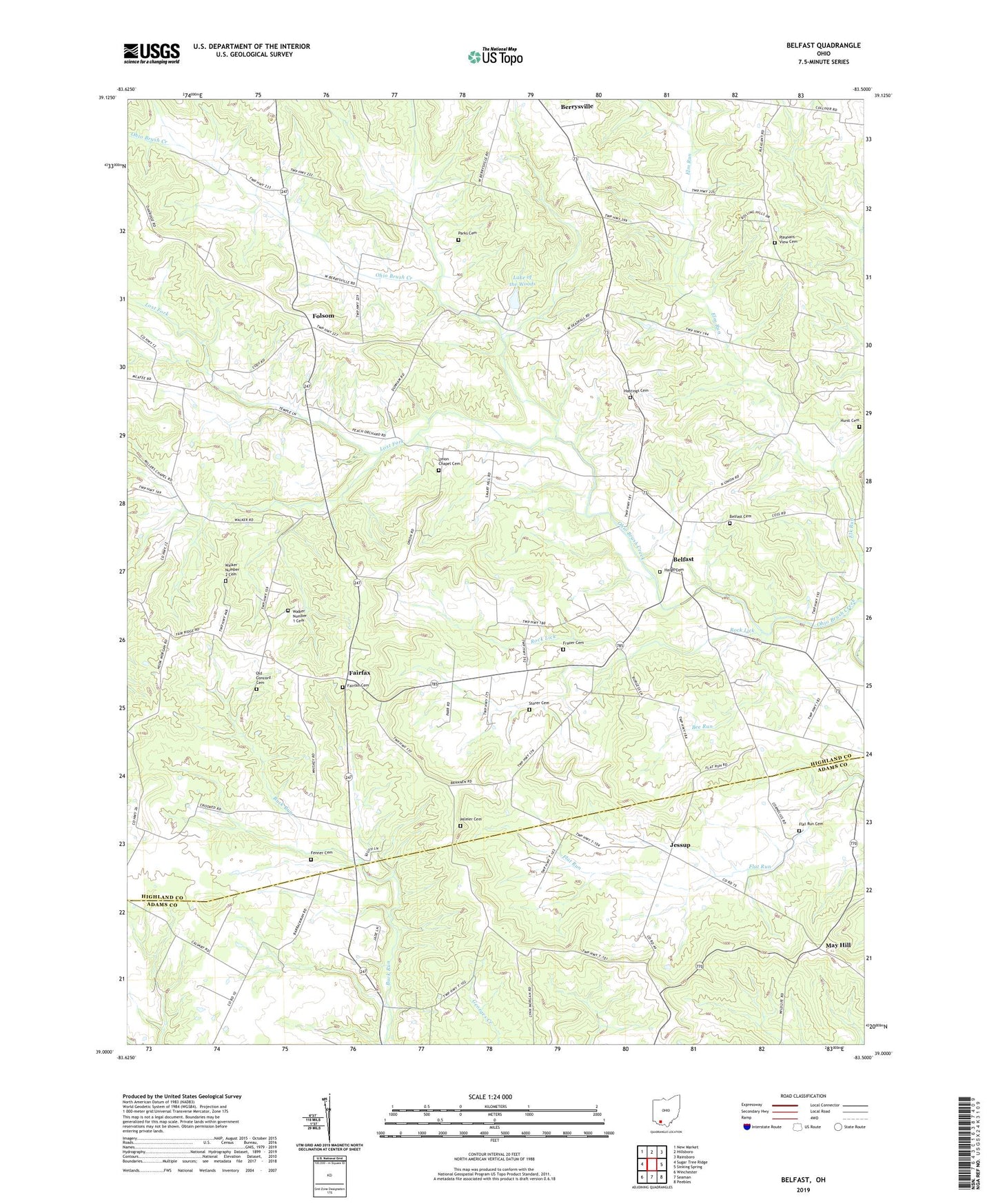
2023 topographic map quadrangle Belfast in the state of Ohio. Scale: 1:24000. Based on the newly updated USGS 7.5' US Topo map series, this map is in the following counties: Highland, Adams. The map contains contour data, water features, and other items you are used to seeing on USGS maps, but also has updated roads and other features. This is the next generation of topographic maps. Printed on high-quality waterproof paper with UV fade-resistant inks.
Quads adjacent to this one:
West: Sugar Tree Ridge
Northwest: New Market
North: Hillsboro
Northeast: Rainsboro
East: Sinking Spring
Southeast: Peebles
South: Seaman
Southwest: Winchester
This map covers the same area as the classic USGS quad with code o39083a5.
Contains the following named places: Bee Run, Beechwood School, Belfast, Belfast Cemetery, Belfast Elementary School, Belfast Post Office, Belfast United Methodist Church, Bethel School, Buckley School, Burnetts Chapel, Calvary School, Deadfall School, Diamond B Mule Farm, Elm Run, Fairfax, Fairfax Cemetery, Fairfax Methodist Church, Fairfax Post Office, Fenner Cemetery, Flat Run Cemetery, Flat Run Church, Folsom, Folsom Post Office, Frazer Cemetery, Garman Farm, Greenbrier School, Haigh Cemetery, Hastings Cemetery, Hurst Cemetery, Jessup, Jessup Post Office, Lake of the Woods, Lake of the Woods Dam, Lost Fork, May Hill, Mayhill Church of Christ, Mayhill Post Office, Mount Zion School, Oak Grove School, Old Concord Cemetery, Palmer Cemetery, Parks Cemetery, Phelps Farm, Pleasant School, Pleasant View Cemetery, Pleasant View Church, Rock Lick, Shannon Farm, Storer Cemetery, Township of Jackson, Township of Washington, Trout School, Union Chapel, Union Chapel Cemetery, Union School, Walker Number 1 Cemetery, Walker Number 2 Cemetery, Walker's Farm, Wildwood School, Zion Church