MyTopo
Winchester Ohio US Topo Map
Couldn't load pickup availability
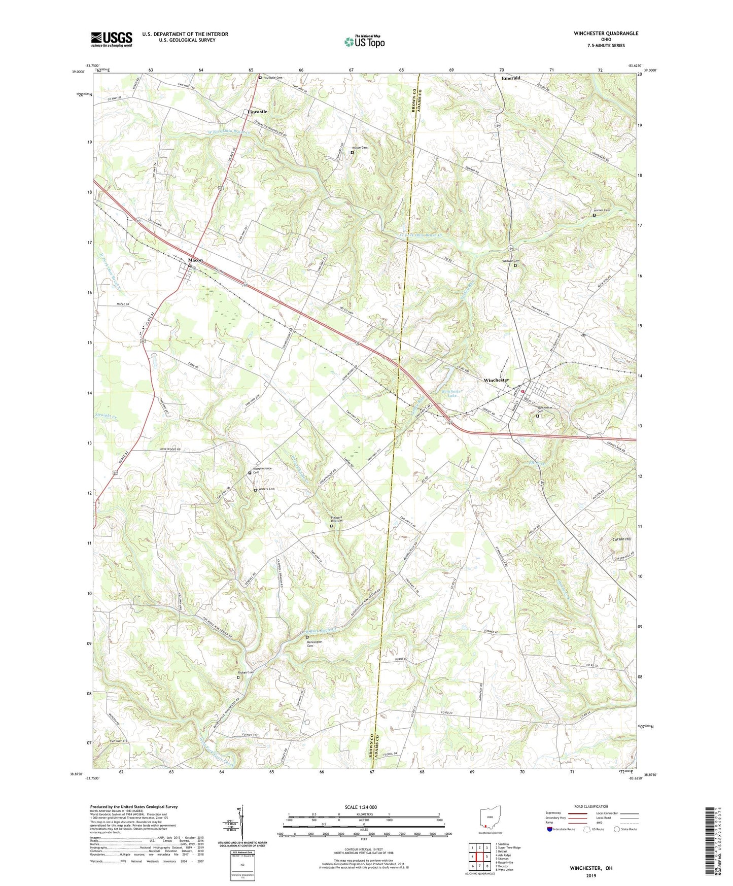
2023 topographic map quadrangle Winchester in the state of Ohio. Scale: 1:24000. Based on the newly updated USGS 7.5' US Topo map series, this map is in the following counties: Brown, Adams. The map contains contour data, water features, and other items you are used to seeing on USGS maps, but also has updated roads and other features. This is the next generation of topographic maps. Printed on high-quality waterproof paper with UV fade-resistant inks.
Quads adjacent to this one:
West: Ash Ridge
Northwest: Sardinia
North: Sugar Tree Ridge
Northeast: Belfast
East: Seaman
Southeast: West Union
South: Decatur
Southwest: Russellville
This map covers the same area as the classic USGS quad with code o38083h6.
Contains the following named places: Bennington Cemetery, Carson Hill, Cross School, Crum Chapel School, Eugene School, Fincastle, Fincastle Baptist Church, Fincastle Cemetery, Fulton School, Harpers Ferry School, Horner Cemetery, Independence Cemetery, Kansan School, Kennedy School, Macon, Macon Post Office, Memorial Park, Mount Olivet Church, Pleasant Hill Cemetery, Pleasant Hill Christian Church, Rickey Cemetery, School Number 6, Township of Eagle, Township of Jackson, Township of Winchester, Turkey Run, Upper Brush Creek School, Village of Winchester, Wallace Cemetery, Waters Cemetery, Wilson Cemetery, Wilson School, Winchester, Winchester - Wayne Township Life Squad, Winchester Cemetery, Winchester Community Fire District, Winchester Elementary School, Winchester Lake, Winchester Lake Dam, Winchester Post Office, ZIP Code: 45697