MyTopo
Cameron Ohio US Topo Map
Couldn't load pickup availability
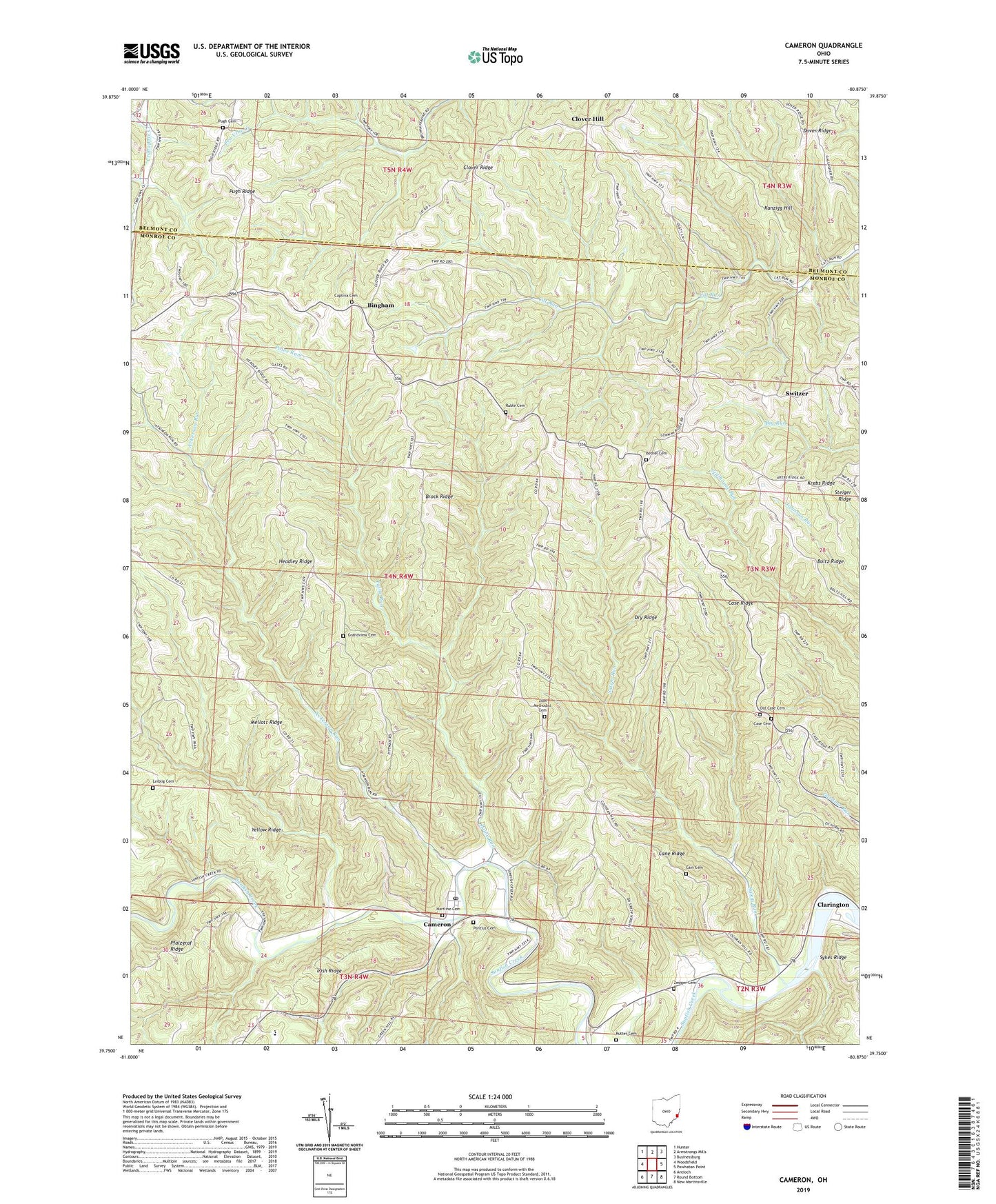
2023 topographic map quadrangle Cameron in the state of Ohio. Scale: 1:24000. Based on the newly updated USGS 7.5' US Topo map series, this map is in the following counties: Monroe, Belmont. The map contains contour data, water features, and other items you are used to seeing on USGS maps, but also has updated roads and other features. This is the next generation of topographic maps. Printed on high-quality waterproof paper with UV fade-resistant inks.
Quads adjacent to this one:
West: Woodsfield
Northwest: Hunter
North: Armstrongs Mills
Northeast: Businessburg
Southeast: New Martinsville
South: Round Bottom
Southwest: Antioch
This map covers the same area as the classic USGS quad with code o39080g8.
Contains the following named places: Ackerson Run, Bethel Cemetery, Bethel Church, Bingham, Bingham Post Office, Brock Ridge, Cain Cemetery, Cameron, Cameron Post Office, Cane Ridge, Captina Cemetery, Captina Church, Case Cemetery, Case Ridge, Clover Hill, Clover Ridge, Dover Ridge, Dry Ridge, Dwight, Dwight Post Office, Grandview Cemetery, Hartline Cemetery, Headley Ridge, Irish Ridge, Kanzigg Hill, Krebs Ridge, Leiblig Cemetery, Mellott Ridge, Mellott Ridge Church, Old Case Cemetery, Paine Run, Pontius Cemetery, Pugh Cemetery, Pugh Ridge, Ruble Cemetery, Rutter Cemetery, Salem Run, Steiger Ridge, Switzer, Switzer Post Office, Township of Adams, Township of Salem, Township of Switzerland, Zesiger Cemetery, Zion Methodist Cemetery, Zion Methodist Church, ZIP Codes: 43914, 43915