MyTopo
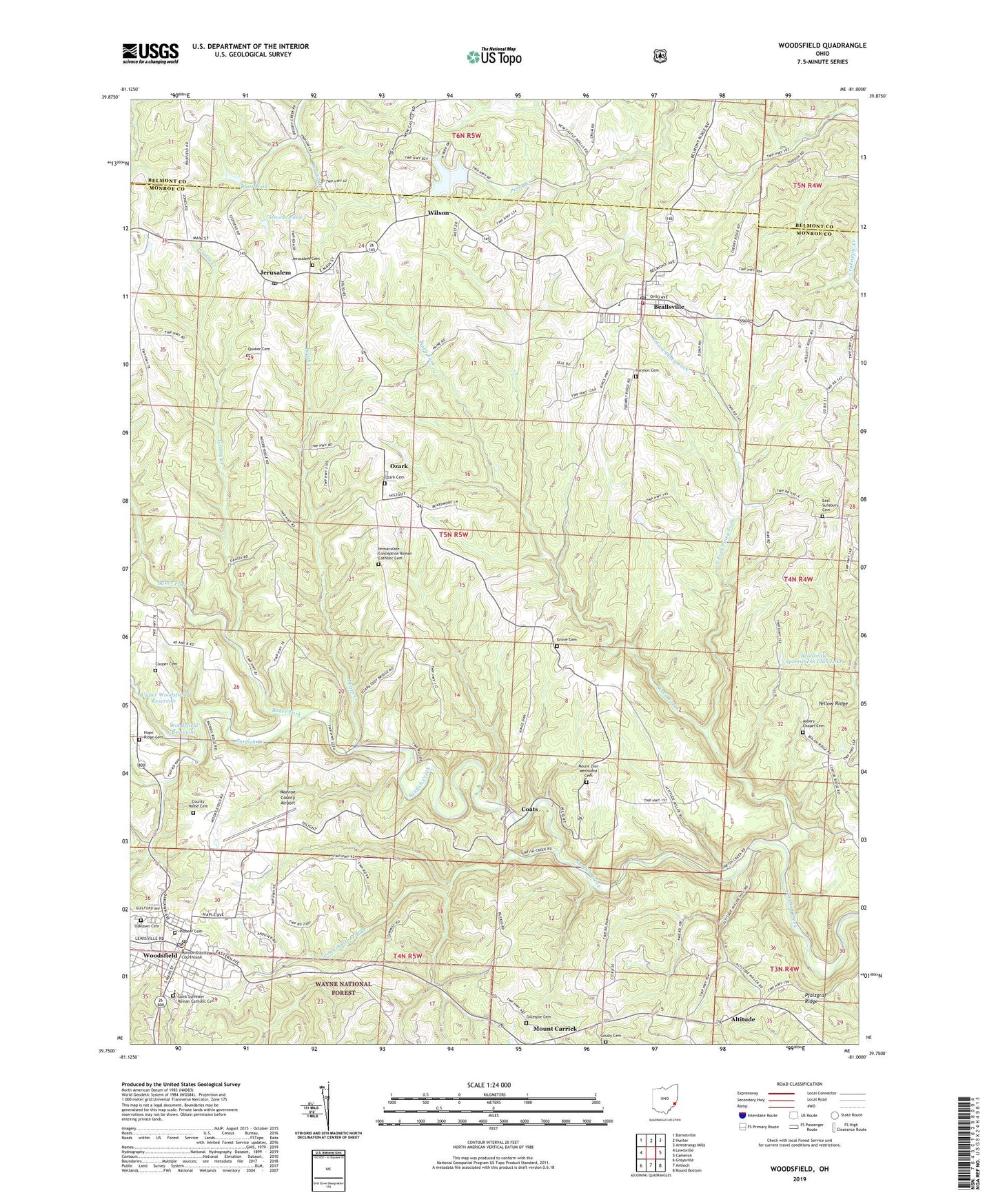
Woodsfield Ohio US Topo Map
Couldn't load pickup availability
Also explore the Woodsfield Forest Service Topo of this same quad for updated USFS data
2023 topographic map quadrangle Woodsfield in the state of Ohio. Scale: 1:24000. Based on the newly updated USGS 7.5' US Topo map series, this map is in the following counties: Monroe, Belmont. The map contains contour data, water features, and other items you are used to seeing on USGS maps, but also has updated roads and other features. This is the next generation of topographic maps. Printed on high-quality waterproof paper with UV fade-resistant inks.
Quads adjacent to this one:
West: Lewisville
Northwest: Barnesville
North: Hunter
Northeast: Armstrongs Mills
East: Cameron
Southeast: Round Bottom
South: Antioch
Southwest: Graysville
This map covers the same area as the classic USGS quad with code o39081g1.
Contains the following named places: Altitude, Asbery Chapel Cemetery, Asbury Chapel, Baker Fork, Beallsville, Beallsville High School, Beallsville Post Office, Beallsville Sportsmens Club Lake, Beallsville Volunteer Fire Department, Blatt Pond, Blatt Pond Dam, Bolon Ridge Church, Buckeye Grove Farm, Coats, Coats Post Office, Cooper Cemetery, County Home Cemetery, Death Creek, East Fork Piney Fork, East Sunsbury Cemetery, East Sunsbury Church, First Baptist Church, First Presbyterian Church, Gillespie Cemetery, Goudy Cemetery, Grassy Creek, Grove Cemetery, Grove Church, Harmon Cemetery, Hope Ridge, Hope Ridge Cemetery, Hope Ridge Post Office, Immaculate Conception Church, Immaculate Conception Roman Catholic Cemetery, Jerusalem, Jerusalem Cemetery, Jerusalem Post Office, Lower Woodsfield Reservoir, Lower Woodsfield Reservoir Dam, Monroe County Airport, Monroe County Courthouse, Monroe County District Library, Monroe County Emergency Medical Services Squad 2 Beallsville, Monroe County Emergency Medical Services Squad 4 Woodsfield, Monroe County Home, Monroe County Sheriff's Office, Mount Carrick, Mount Carrick Post Office, Mount Zion Church, Mount Zion Methodist Cemetery, Oaklawn Cemetery, Ozark, Ozark Cemetery, Ozark Post Office, Pfalzgraf Ridge, Piney Fork, Pioneer Cemetery, Quaker Cemetery, Saint Pauls United Church of Christ, Saint Sylvester Roman Catholic Cemetery, Saint Sylvesters Catholic Church, Saint Sylvesters School, Standingstone Run, Stevens Pond, Stevens Pond Dam, Switzerland Lake, Switzerland Lake Dam, Township of Center, Township of Sunsbury, United Methodist Church of Woodsfield, Upper Woodsfield Reservoir, Upper Woodsfield Reservoir Dam, Village of Beallsville, Village of Jerusalem, Village of Wilson, Village of Woodsfield, Wilson, Woodsfield, Woodsfield Elementary School, Woodsfield High School, Woodsfield Municipal Police Department, Woodsfield Post Office, Woodsfield Reservoir, Yellow Ridge, ZIP Codes: 43716, 43747